Harper's Brook
| Harper's Brook | |
|---|---|
 Harper's Brook at Lowick | |
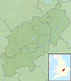
Location of the river mouth in Northamptonshire | |
| Location | |
| Sovereign State | United Kingdom |
| Country | England |
| County | Northamptonshire |
| Physical characteristics | |
| Source | |
| • location | Desborough |
| • coordinates | 52°27′38″N 0°48′50″W / 52.460459°N 0.814013°W |
| • elevation | 137 m (449 ft) |
Aldwinckle | |
• coordinates | 52°25′43″N 0°30′23″W / 52.428576°N 0.506414°W |
• elevation | 28 m (92 ft) |
| Basin size | 73.26 km2 (28.29 sq mi) |
| Basin features | |
| River system | River Nene |
Harper's Brook is a tributary of the River Nene which runs through Northamptonshire.
According to sources (ordnance survey sheet 141) it rises to the North of
Aldwinckle, just north of Thrapston
.

