Harrell Prairie Botanical Area
| Harrell Prairie Botanical Area | |
|---|---|
| Harrell Prairie Hill | |
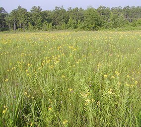
 Harrell Prairie Hill, a landmark in the area | |
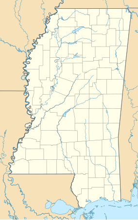
Map of Mississippi | |
| Location | Scott County, Mississippi |
| Nearest city | Forest |
| Coordinates | 32°20′09″N 89°26′23″W / 32.33583°N 89.43972°W |
| Area | 160 acres (65 ha) |
| Established | 1980 |
| Designated | 1976 |
Harrell Prairie Botanical Area or Harrell Prairie Hill is a 160-acre (65 ha)
Jackson Prairie Belt in Mississippi. It was declared a National Natural Landmark in May 1976[1] and a Botanical Area by the Forest Service in 1980.[2]
Description
There are 68 identified prairies in the National Forest, locally called cedar fields, which avoided agriculture development due to their purchase by lumber companies.[2] Harrell Hill contains the "largest and least disturbed" example of the Jackson Prairie in Mississippi.[2][3] The Jackson Prairie is a disjunct of the Black Belt (or Black Prairie) physiographic area in Mississippi and Alabama.[3]
The
Rudbeckia pinnata), Eastern Purple Coneflower (Echinacea purpurea), Blazing Star (Liatris spp.), False Boneset (Brickellia eupatorioides var. eupatorioides), Green Milkweed (Asclepias hirtella), Green Comet Milkweed (A. viridiflora), Purple Prairie Clover (Dalea purpurea var. purpurea), White Prairie Clover (D. candida var. candida), Aster (Symphyotrichum spp.), Tick-trefoil (Desmodium spp.), Rosepink (Sabatia angularis), Smooth Oxeye (Heliopsis helianthoides), Little-leaved Mountain Mint (Pycnanthemum tenuifolium) and Wild Bergamot (Monarda fistulosa).[2][5]
It is also an example of the geophysical transformation of the
Mississippi River delta.[6]
Visiting
There are no trails or facilities in the area. There is parking along the side of
leave no trace policy to protect the rare species.[4]
References
- ^ "National Natural Landmark Summary". National Park Service. February 5, 2004. Retrieved 2009-03-31.
- ^ ISBN 978-0-87805-664-4. Retrieved 2009-03-30.
- ^ a b c "Harrell Prairie Botanical Area". USDA Forest Service. Retrieved 2009-03-31.
- ^ a b "Holly Springs, Tombigbee, Delta, Bienville, De Soto, and Homochitto National Forests". GORP.com. Archived from the original on 2010-05-01. Retrieved 2009-03-31.
- ISBN 978-0-520-23984-5.
- ^ "Concept 2: Transforming the Mississippi River: Manipulating the Mississippi River System to Facilitate Navigation and Manage Flood Flows" (PDF). National Park Service. Retrieved 2009-03-31.


