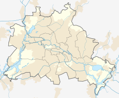
Hermannplatz (Berlin U-Bahn)
This article needs additional citations for verification. (June 2019) |
Hermannplatz island platforms | ||||||||||||||||
|---|---|---|---|---|---|---|---|---|---|---|---|---|---|---|---|---|
| Tracks | 4 | |||||||||||||||
| Train operators | Berliner Verkehrsbetriebe | |||||||||||||||
| Connections | ||||||||||||||||
| Construction | ||||||||||||||||
| Structure type | Underground | |||||||||||||||
| Other information | ||||||||||||||||
| Fare zone | VBB: Berlin A/5555[1] | |||||||||||||||
| History | ||||||||||||||||
| Opened | 11 April 1926 (U7) 17 July 1927 (U8) | |||||||||||||||
| Services | ||||||||||||||||
| ||||||||||||||||
| ||||||||||||||||
Hermannplatz is a station in the Neukölln district of Berlin which serves as an interchange between the lines U7 and U8. Operated by the BVG, it is one of the busiest stations on the Berlin U-Bahn system.
History


Hermannplatz station first opened on 11 April 1926 together with the rest of the newly built line between the stations
Unique that time was Karstadt department store got a tunnel for customers directly to its facility. Refer to U8 and Wertheim, rumors to have paid for change route around Moritzplatz to same station building connection.
Until 1930, tram lines were present on all the streets converging on Hermannplatz, and it was served by no fewer than 15 separate routes. In the following years however, there was a gradual reduction in tram provisioning in the former West Berlin, and the last tram ran to Hermannplatz on 1 October 1964.
Today, the square is a hub of activity in one of the most densely populated areas of Berlin. It has therefore retained its status as a transport
. On U8 the next station is Schönleinstraße or Boddinstraße. Located at the extreme southeast corner of the inner-city district of Kreuzberg, the square was and still is considered the gateway to Neukölln.See also
References
- ^ "Der VBB-Tarif: Aufteilung des Verbundgebietes in Tarifwaben und Tarifbereiche" (PDF). Verkehrsbetrieb Potsdam. Verkehrsverbund Berlin-Brandenburg. 1 January 2017. Retrieved 25 November 2019.

