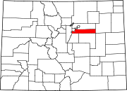
Holly Hills, Colorado
Holly Hills, Colorado | |
|---|---|
303 & 720 | |
| GNIS feature[2] | Holly Hills CDP |
Holly Hills is an
United States Census 2020. The Denver post office 80222 serves the area.[4]
Geography
The Holly Hills CDP has an area of 371 acres (1.503 km2), all land.[1]
Demographics
The
United States Census 2010
.
| Year | Pop. | ±% |
|---|---|---|
| 2010 | 2,521 | — |
| 2020 | 2,683 | +6.4% |
| Source: United States Census Bureau | ||
See also
- Outline of Colorado
- State of Colorado
- Colorado cities and towns
- Colorado census designated places
- Colorado counties
- Colorado metropolitan areas
- Front Range Urban Corridor
- North Central Colorado Urban Area
- Denver-Aurora-Boulder, CO Combined Statistical Area
- Denver-Aurora-Broomfield, CO Metropolitan Statistical Area
References
- ^ a b c "State of Colorado Census Designated Places - BAS20 - Data as of January 1, 2020". United States Census Bureau. Retrieved December 13, 2020.
- ^ a b c "U.S. Board on Geographic Names: Domestic Names". United States Geological Survey. Retrieved December 13, 2020.
- ^ United States Census Bureau. "Holly Hills CDP, Colorado". Retrieved April 18, 2023.
- ^ a b "Zip Code 80222 Map and Profile". zipdatamaps.com. 2020. Retrieved December 20, 2020.

