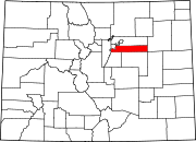
Strasburg, Colorado
Appearance
Strasburg, Colorado | |
|---|---|
303 & 720 | |
| GNIS feature[2] | Strasburg CDP |
Strasburg is an
United States Census 2020, the population of the Strasburg CDP was 3,307.[3]
History
The community was named after John Strasburg, a railroad official.[5] Strasburg may now be considered a commuter community as new housing continues to be built and much of the populace works in the surrounding areas of Aurora, Brighton, and Denver.
The town is built next to the Comanche Crossing of the Kansas Pacific Railroad. A post office called Strasburg has been in operation since 1908.[6]
Geography
The Strasburg CDP has an area of 13,331 acres (53.949 km2), including 16 acres (0.064 km2) of water.[1]
Demographics
The
United States Census 2000
.
| Year | Pop. | ±% |
|---|---|---|
| 2000 | 1,402 | — |
| 2010 | 2,447 | +74.5% |
| 2020 | 3,307 | +35.1% |
| Source: United States Census Bureau | ||
Education
The Strasburg School District 31J serves Strasburg.
See also
- Outline of Colorado
- State of Colorado
- Colorado cities and towns
- Colorado census designated places
- Colorado counties
- List of statistical areas in Colorado
- Front Range Urban Corridor
- North Central Colorado Urban Area
- Denver-Aurora-Boulder, CO Combined Statistical Area
- Denver-Aurora-Broomfield, CO Metropolitan Statistical Area
References
- ^ a b c "State of Colorado Census Designated Places - BAS20 - Data as of January 1, 2020". United States Census Bureau. Retrieved December 9, 2020.
- ^ a b c "U.S. Board on Geographic Names: Domestic Names". United States Geological Survey. Retrieved December 9, 2020.
- ^ a b United States Census Bureau. "Strasburg CDP, Colorado". Retrieved April 10, 2023.
- ^ a b "Look Up a ZIP Code". United States Postal Service. Retrieved December 9, 2020.
- ^ Dawson, John Frank. Place names in Colorado: why 700 communities were so named, 150 of Spanish or Indian origin. Denver, CO: The J. Frank Dawson Publishing Co. p. 48.
- ^ "Post offices". Jim Forte Postal History. Retrieved July 11, 2016.


