
Huamashraju
| Huamashraju | |
|---|---|
| Yanahuacra, Rajo Colta | |
 | |
| Highest point | |
| Elevation | 5,434 m (17,828 ft) |
| Coordinates | 9°31′30″S 77°23′06″W / 9.52500°S 77.38500°W |
| Geography | |
 Huamashraju Peru | |
| Location | Ancash Region |
| Parent range | Andes, Cordillera Blanca |
| Climbing | |
| First ascent | 1954, J. Cabana and A. Soriano[1] |
Huamashraju,Ancash Region, Huaraz Province, Huaraz District. Huamashraju lies east of the town of Huaraz, west of Huantsán and northwest of Shacsha and Cashan.
Gallery
-
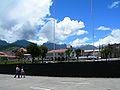
 Huamashraju as seen from Huaraz
 -
 Ranrapalca (in the distance), Rima Rima, Churup (middle, left), Collapaco and Huamashraju as seen from Huaraz
 -
 Ranrapalca (on the left), Huamashraju, Cashan, Shacsha (center) and Huantsán (on the right) as seen from the southwest


See also
References
- ^ a b "Huamashraju". www.montanasperuanas.com. Retrieved 2016-06-22.
- ^ ISBN 3-937530-05-3.
- ^ ISBN 0-907649-64-5.
- ^ Ricker, John (1977). Yuraq Janka: A Guide to the Peruvian Andes. The Mountaineers Books. pp. 109–111.
- ^ "babylon.com". Archived from the original on 2014-12-29. Retrieved 2013-03-17.
- ^ a b Peru 1:100 000, Recuay (20-i). IGN (Instituto Geográfico Nacional - Perú).