
Islington Tunnel
Regent's Canal | |
| Start | 51°31′59.37″N 0°6′9.67″W / 51.5331583°N 0.1026861°W |
|---|---|
| End | 51°32′5.12″N 0°6′54.07″W / 51.5347556°N 0.1150194°W |
| Operation | |
| Opened | 1818 |
| Owner | Canal & River Trust |
| Technical | |
| Design engineer | James Morgan |
| Length | 960 yards (878 m) |
| Towpath | No |
| Boat-passable | Yes |
The Islington Tunnel takes the
History
Islington Tunnel opened in 1818 and was built by the engineer James Morgan.[1]
The Regent's Canal was authorised by
The company was persistently short of money, as it had only succeeded in raising £254,100 of the estimated cost of £400,000, and as work progressed, it became obvious that more would be needed. The first section from
The tunnelling contract was given to Daniel Pritchard, who had previous experience building tunnels for the Grand Union Canal at Husbands Bosworth and Crick. The first was built between 1811 and 1813, and was 1,170 yards (1,070 m) long, while the second was built between 1812 and 1814, and was 1,528 yards (1,397 m) long. They had been completed despite encountering difficult geology along their routes. With the completion of the 960-yard (878 m) Islington Tunnel and the nearby Maida Hill Tunnel, he went on to be a specialist tunnelling contractor, completing the Strood Tunnel on the Thames and Medway Canal and the second Harecastle Tunnel on the Trent and Mersey Canal.[4]
Lacking towpath, barges originally had to be legged through the tunnel. In 1826 it was upgraded with a steam tug pulling a guiding chain above the centre of the bed which would propel the barges; which remained until the 1930s,[5] when it was replaced with a diesel engine, now defunct due to boats' motor propulsion.
Route
There is no towpath. Walkers or cyclists wishing to follow the tunnel are helped by a trail of waymarkers which have been set into the pavements above. From the eastern portal heading towards the west, the trail runs up Duncan Street, then left down Islington High Street to the crossing near Angel Underground Station, across High Street and up Liverpool Road, turning left into Chapel Market. At the end of Chapel Market it turns right into Penton Street, and finally left into Maygood Street. At the end of Maygood Street it passes through a small residential zone, before ultimately ending in Muriel Street, from where the towpath may be accessed.
Gallery
-
 Western Portal
 -
 Older style waymarker
 -
 Modern style waymarker
 -
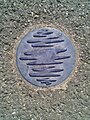 Smaller waymarker


See also
Bibliography
- Skempton, Sir Alec; et al. (2002). A Biographical Dictionary of Civil Engineers in Great Britain and Ireland: Vol 1: 1500 to 1830. Thomas Telford. ISBN 0-7277-2939-X.
- Hadfield, Charles (1970). The Canals of the East Midlands. David and Charles. ISBN 0-7153-4871-X.
References
- ^ "James Morgan". London Canal Museum. Retrieved 28 December 2011.
- ^ Skempton 2002, p. 452
- ^ Hadfield 1970, p. 130
- ^ Skempton 2002, pp. 537–538
- ^ Hadfield 1970, p. 133