
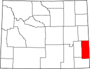
Jay Em, Wyoming
Jay Em, Wyoming | ||
|---|---|---|
ZIP codes 82219 | ||
| GNIS feature ID | 1590066[1] | |
Jay Em is an
History

Nat'l Register of Historic Places
The site of the town was a watering hole on old Texas Trail. The land around the watering hole was claimed by Jim Moore (d.1875) in the 1860s. By 1869, Moore had the second largest cattle ranch in the Wyoming Territory, under the brand "J Rolling M", from which the community and "Jay Em Creek" would take later their names.[4]
The town was established to support ranchers in the surrounding area by Lake Harris between 1912 and 1915, and by 1915 a

In August 2017 the town hosted thousands of visitors who came to view the Solar eclipse of August 21, 2017[5]
Historic district
The center of the original community is included in the Jay Em Historic District, and listed on the National Register of Historic Places.[4]
Education
Public education for the community of Jay Em is provided by Goshen County School District #1.
Main highway
References
- ^ a b "Jay Em, Wyoming". Geographic Names Information System. United States Geological Survey, United States Department of the Interior.
- ^ Rand McNally. The Road Atlas '08. Chicago: Rand McNally, 2008, p. 116.
- ^ Zip Code Lookup
- ^ a b c Gorman, Michael (1984). "National Register of Historic Places Inventory - Nomination Form: Jay Em Historic District". National Park Service. Retrieved June 11, 2009.
- ^ "The Total Solar Eclipse Experience at Jay Em, Wyoming". August 22, 2017.
External links
![]() Media related to Jay Em, Wyoming at Wikimedia Commons
Media related to Jay Em, Wyoming at Wikimedia Commons
 | ||||
Towns |
| |||
| CDPs | ||||
| Unincorporated community | ||||
| ||||