
Fort Laramie, Wyoming
Fort Laramie, Wyoming | ||
|---|---|---|
Town | ||
FIPS code 56-28230[3] | | |
| GNIS feature ID | 1588642[4] | |
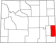
Fort Laramie is a town in
History

In 1860 Fort Laramie served as a Pony Express station.
Geography
Fort Laramie is located at 42°12′48″N 104°31′2″W / 42.21333°N 104.51722°W (42.213233, -104.517123).[5]
According to the United States Census Bureau, the town has a total area of 0.25 square miles (0.65 km2), all land.[1]
Climate
According to the
| Climate data for Old Fort Laramie, Wyoming, 1991–2020 normals, extremes 1989–present | |||||||||||||
|---|---|---|---|---|---|---|---|---|---|---|---|---|---|
| Month | Jan | Feb | Mar | Apr | May | Jun | Jul | Aug | Sep | Oct | Nov | Dec | Year |
| Record high °F (°C) | 72 (22) |
72 (22) |
81 (27) |
89 (32) |
98 (37) |
105 (41) |
106 (41) |
104 (40) |
102 (39) |
92 (33) |
80 (27) |
73 (23) |
106 (41) |
| Mean maximum °F (°C) | 61.0 (16.1) |
63.4 (17.4) |
74.0 (23.3) |
81.0 (27.2) |
89.1 (31.7) |
96.5 (35.8) |
100.4 (38.0) |
98.8 (37.1) |
94.4 (34.7) |
84.4 (29.1) |
71.4 (21.9) |
61.4 (16.3) |
101.3 (38.5) |
| Mean daily maximum °F (°C) | 43.0 (6.1) |
45.0 (7.2) |
54.8 (12.7) |
61.9 (16.6) |
71.0 (21.7) |
82.8 (28.2) |
91.0 (32.8) |
89.2 (31.8) |
79.8 (26.6) |
65.2 (18.4) |
52.0 (11.1) |
42.6 (5.9) |
64.9 (18.3) |
| Daily mean °F (°C) | 29.1 (−1.6) |
31.0 (−0.6) |
39.1 (3.9) |
46.0 (7.8) |
55.8 (13.2) |
66.4 (19.1) |
73.8 (23.2) |
71.6 (22.0) |
61.8 (16.6) |
48.2 (9.0) |
37.0 (2.8) |
29.0 (−1.7) |
49.1 (9.5) |
| Mean daily minimum °F (°C) | 15.3 (−9.3) |
17.1 (−8.3) |
23.5 (−4.7) |
30.1 (−1.1) |
40.6 (4.8) |
50.0 (10.0) |
56.5 (13.6) |
54.1 (12.3) |
43.8 (6.6) |
31.1 (−0.5) |
22.1 (−5.5) |
15.4 (−9.2) |
33.3 (0.7) |
| Mean minimum °F (°C) | −13.4 (−25.2) |
−9.5 (−23.1) |
3.2 (−16.0) |
14.2 (−9.9) |
25.1 (−3.8) |
36.4 (2.4) |
44.1 (6.7) |
40.9 (4.9) |
27.1 (−2.7) |
11.2 (−11.6) |
−1.4 (−18.6) |
−12.3 (−24.6) |
−21.4 (−29.7) |
| Record low °F (°C) | −28 (−33) |
−36 (−38) |
−18 (−28) |
0 (−18) |
18 (−8) |
28 (−2) |
37 (3) |
29 (−2) |
20 (−7) |
−16 (−27) |
−16 (−27) |
−40 (−40) |
−40 (−40) |
| Average precipitation inches (mm) | 0.24 (6.1) |
0.53 (13) |
0.80 (20) |
1.71 (43) |
2.93 (74) |
2.19 (56) |
1.78 (45) |
1.36 (35) |
1.39 (35) |
1.13 (29) |
0.46 (12) |
0.42 (11) |
14.94 (379.1) |
| Average snowfall inches (cm) | 2.2 (5.6) |
6.3 (16) |
3.1 (7.9) |
3.5 (8.9) |
0.6 (1.5) |
0.0 (0.0) |
0.0 (0.0) |
0.0 (0.0) |
0.0 (0.0) |
2.4 (6.1) |
3.2 (8.1) |
6.2 (16) |
27.5 (70.1) |
| Average extreme snow depth inches (cm) | 2.4 (6.1) |
3.6 (9.1) |
2.6 (6.6) |
2.2 (5.6) |
0.7 (1.8) |
0.0 (0.0) |
0.0 (0.0) |
0.0 (0.0) |
0.0 (0.0) |
1.3 (3.3) |
2.3 (5.8) |
3.3 (8.4) |
6.3 (16) |
| Average precipitation days (≥ 0.01 in) | 3.5 | 4.6 | 4.9 | 7.3 | 9.8 | 7.7 | 6.8 | 5.7 | 5.5 | 5.5 | 4.0 | 4.2 | 69.5 |
| Average snowy days (≥ 0.1 in) | 1.9 | 2.8 | 1.7 | 1.6 | 0.3 | 0.0 | 0.0 | 0.0 | 0.0 | 1.1 | 1.8 | 2.9 | 14.1 |
| Source 1: NOAA[7] | |||||||||||||
| Source 2: National Weather Service[6] | |||||||||||||
Demographics
| Census | Pop. | Note | %± |
|---|---|---|---|
| 1930 | 245 | — | |
| 1940 | 311 | 26.9% | |
| 1950 | 300 | −3.5% | |
| 1960 | 233 | −22.3% | |
| 1970 | 197 | −15.5% | |
| 1980 | 356 | 80.7% | |
| 1990 | 243 | −31.7% | |
| 2000 | 243 | 0.0% | |
| 2010 | 230 | −5.3% | |
| 2020 | 206 | −10.4% | |
| U.S. Decennial Census | |||

2010 census
As of the
There were 111 households, of which 19.8% had children under the age of 18 living with them, 43.2% were married couples living together, 7.2% had a female householder with no husband present, 3.6% had a male householder with no wife present, and 45.9% were non-families. 43.2% of all households were made up of individuals, and 19.8% had someone living alone who was 65 years of age or older. The average household size was 2.07 and the average family size was 2.88.
The median age in the town was 49.5 years. 18.3% of residents were under the age of 18; 4.7% were between the ages of 18 and 24; 20% were from 25 to 44; 32.6% were from 45 to 64; and 24.3% were 65 years of age or older. The gender makeup of the town was 53.5% male and 46.5% female.
2000 census
As of the
There were 119 households, out of which 20.2% had children under the age of 18 living with them, 39.5% were married couples living together, 6.7% had a female householder with no husband present, and 50.4% were non-families. 42.0% of all households were made up of individuals, and 21.0% had someone living alone who was 65 years of age or older. The average household size was 2.04 and the average family size was 2.86.
In the town, the population was spread out, with 21.8% under the age of 18, 4.5% from 18 to 24, 24.3% from 25 to 44, 25.9% from 45 to 64, and 23.5% who were 65 years of age or older. The median age was 45 years. For every 100 females, there were 91.3 males. For every 100 females age 18 and over, there were 84.5 males.
The median income for a household in the town was $22,500, and the median income for a family was $32,917. Males had a median income of $28,929 versus $13,125 for females. The
Education
Public education for the town of Fort Laramie is provided by Goshen County School District #1.
Highways
- U.S. Highway 26
 WYO 160
Notable people
- U.S. Representative for Wyoming's at-large congressional district(2023–present)
- Innis P. Swift (1882–1953), United States Army general
See also
References
- ^ a b "2020 U.S. Gazetteer Files". United States Census Bureau. Retrieved March 22, 2024.
- ^ "Profile of General Population and Housing Characteristics: 2020 Demographic Profile Data (DP-1): Fort Laramie town, Wyoming". United States Census Bureau. Retrieved March 22, 2024.
- ^ a b "U.S. Census website". United States Census Bureau. Retrieved January 31, 2008.
- ^ "US Board on Geographic Names". United States Geological Survey. October 25, 2007. Retrieved January 31, 2008.
- ^ "US Gazetteer files: 2010, 2000, and 1990". United States Census Bureau. February 12, 2011. Retrieved April 23, 2011.
- ^ a b "NOAA Online Weather Data – NWS Cheyenne". National Weather Service. Retrieved November 1, 2022.
- ^ "U.S. Climate Normals Quick Access – Station: Old Ft Laramie, WY". National Oceanic and Atmospheric Administration. Retrieved November 1, 2022.
- ^ "U.S. Census website". United States Census Bureau. Retrieved December 14, 2012.
 | ||||
Towns |
| |||
| CDPs | ||||
| Unincorporated community | ||||
| ||||
| International | |
|---|---|
| National | |