
Joyce Kilmer Memorial Forest
| Joyce Kilmer Memorial Forest | |
|---|---|
wilderness area) | |
 | |
 | |
| Location | Graham County, North Carolina , USA |
| Nearest city | Robbinsville, North Carolina |
| Coordinates | 35°22′25″N 83°58′32″W / 35.37361°N 83.97556°W |
| Area | 3,800 acres (15 km2) |
| Established | 1936 |
| Governing body | U.S. Forest Service |


Joyce Kilmer Memorial Forest is an approximately 3,800-acre tract of publicly owned virgin forest in
History
Beginning in 1915, the Babcock Lumber Company of Pittsburgh operated a standard gauge railroad in the area,[1] logging out roughly two-thirds of the Slickrock Creek watershed before construction of Calderwood Dam threatened to flood the lower part of the railroad.[2] A decline in the price of lumber during the Great Depression also encouraged preservation of the trees.[3]
In 1934 the Bozeman Bulger Post (New York) of the Veterans of Foreign Wars petitioned "that the government of the United States examine its millions of forested acres and set aside a fitting area of trees to stand for all time as a living memorial" to Kilmer, a poet and journalist killed during World War I, whose 1913 poem "Trees" had become a popular favorite. After considering forests throughout the country, the Forest Service decided on an uncut 3,800-acre (15 km2) area along Little Santeetlah Creek, which was dedicated as the Joyce Kilmer Memorial Forest on July 30, 1936.[4]
Importance
The memorial is a rare example of old growth cove hardwood forest, a diverse type unique to the Appalachian Mountains. Dominant species are yellow-poplar, oak, basswood, beech, and sycamore. Some trees are over 400 years old, and the oldest yellow-poplars are more than 20 feet (6.1 m) in circumference and stand 100 feet (30 m) tall.
Missing is the
Images
-
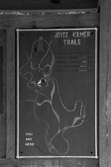 Trail map
 -
 Dedication plaque
 -
 Trail
Trail -
 Creek
Creek


References
- ^ John B. Veach, “The History of Railroading in Graham County.”
- ^ "Joyce Kilmer-Slick Rock Wilderness," map, U.S. Department of Agriculture, Forest Service, Southern Region, c. 1980. The rails were removed, but occasional remnants of the railroad are detectable in the Slickrock Wilderness.
- ^ "Joyce Kilmer Memorial Forest," pamphlet, U. S. Department of Agriculture, 2004 [R8-RG 232]
- ^ Alberta Brewer and Carson Brewer, Valley So Wild (Knoxville: East Tennessee Historical Society, 1975), 350-351.
- ^ "Joyce Kilmer-Slick Rock Wilderness," map, c. 1980. Occasional chestnut sprouts may also still be found.
- ^ Smoky Mountain News, November 24, 2010.; Carolina Public Press, July 29, 2011 The lower trail vaguely resembles a battlefield—an ironic result at a memorial dedicated to a war casualty.
| International | |
|---|---|
| National | |