
Kamela, Oregon
Kamela is an unincorporated community in Union County, Oregon, United States.[1] It is located west of Interstate 84 about 20 miles northwest of La Grande.[2]
There are several stories about how the community got its name.Mikecha, was made up of the names of three civil engineers—Mink, Kennedy, and Chalk—and the compiler of Oregon Geographic Names believed that this name was confused with Kamela.[3] Kamela post office ran from 1887 to 1949.[3]
Kamela is the highest railroad pass in the
Blue Mountains, with an elevation of 4,206 feet (1,282 m).[4] Kamela had a roundhouse and served as a wood and timber handling point for the railroad.[5] In 1904, the population of the community was 220.[5] In 1940 Kamela had a population of 27.[4] At one time the community had a school.[6] One of the last Oregon train robberies began in Kamela in 1914.[7][8]
References
- ^ "Kamela". Geographic Names Information System. United States Geological Survey, United States Department of the Interior. November 28, 1980. Retrieved February 6, 2012.(no longer supported)
- ISBN 0-89933-347-8.
- ^ ISBN 978-0875952772.
- ^ OCLC 4874569.
- ^ a b Wood, Stanley (1904). Over the Range to the Golden Gate A Complete Tourist's Guide To Colorado, New Mexico, Utah, Nevada, California, Oregon, Puget Sound, and the Great Northwest. R. R. Donnelley. p. 316.
- ^ "County Superintendents' Department: Union County". Oregon Teachers Monthly. 21 (1). Oregon State Teachers' Association: 99. September 1916.
- ISBN 0-933472-89-7.
- ^ Mason, Dick (October 17, 2011). "Was there a train robbery at Kamela many years ago?". The Observer. Retrieved February 6, 2012.
External links
- Images of Kamela from Flickr
45°26′03″N 118°23′37″W / 45.434296°N 118.393568°W
Municipalities and communities of Union County, Oregon, United States | ||
|---|---|---|
| Cities | 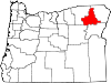 | |
| Unincorporated communities | ||
| Indian reservation | ||
| Ghost town | ||
| ||