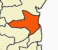
Kattumannarkoil block
11°16′22″N 79°33′20″E / 11.2727°N 79.5555°E Kattumannarkoil block is a
panchayat villages.Total area of Kattumannarkoil is 455 km2 including 406.38 km2 rural area and 48.74 km2 urban area.Kattumannarkoil has a population of 2,76,947 peoples. There are 67,752 houses in the sub-district. There are about 147 villages in Kattumannarkoil block .[2]
References
- ^ "Archived copy". Archived from the original on 27 September 2011. Retrieved 28 August 2011.
{{cite web}}: CS1 maint: archived copy as title (link) - ^ "Blocks". Archived from the original on 7 August 2011. Retrieved 28 August 2011.
LALPET(LALGAANPET)

