Kengeede
| Kengeede Кэнгээдэ / Күҥгэдэ | |
|---|---|
Yakutia, Russia | |
| Location | |
| Country | Russia |
| Physical characteristics | |
| Source | |
| • location | Central Siberian Plateau |
| Mouth | Arga-Sala |
• coordinates | 68°31′08″N 111°55′47″E / 68.51889°N 111.92972°E |
• elevation | 108 m (354 ft) |
| Length | 241 km (150 mi) |
| Basin size | 7,610 km2 (2,940 sq mi) |
| Basin features | |
| Progression | Arga-Sala→Olenyok→Laptev Sea |
The Kengeede (
The river basin is a lonely, desolate area devoid of settlements.[3]
Course
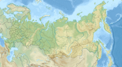
The Kengeede is a left tributary of the Arga-Sala. Its sources are in the southern end of the Anabar Plateau, south of the basin of the Bolshaya Kuonamka. The river flows roughly southwards , to the east of the Kyuyonelekeen. It heads across mountainous taiga areas with rapids and riffles in numerous sections. In its upper course it bends eastwards, then for a stretch northeastwards, and then again southwards, heading in that direction for the remainder of its course. Finally it joins the left bank of the Arga-Sala river 12 km (7.5 mi) from its mouth, not far upstream of Olenyok village, Olenyoksky District, one of the few inhabited localities of the area.[5][3]
The river is frozen between the first half of October and late May or early June.[6]
Tributaries
Its main tributaries are the 44 km (27 mi) long Talakhtaakh (Талахтаах), the 109 km (68 mi) long Osur (Осур), the 85 km (53 mi) long Tokur (Токур) and the 58 km (36 mi) long Budurkhai (Будьурхай) from the left, as well as the 63 km (39 mi) long Kuraanakh (Кураанах) and the 54 km (34 mi) long Kharaap (Хараап) from the right.[4]
See also
References
- ^ Operational Navigation Chart C-5, 2nd edition
- ^ Национальный Атлас России - National Atlas of Russia (Кенгяде)
- ^ a b c "Топографска карта R-49 50; M 1:1 000 000 - Topographic USSR Chart (in Russian)". Retrieved 8 May 2022.
- ^ a b "Река Кэнгээдэ in the State Water Register of Russia". textual.ru (in Russian).
- ^ Google Earth
- ^ Кенгеде nature.ykt.ru

