
Kleiner Solstein
| Kleiner Solstein | |
|---|---|
Tyrol, Austria
| |
Wetterstein Limestone[1] | |
| Climbing | |
| First ascent | 1867 by Pock, Wechner, Angermaier |
| Normal route | Ascent from the west |
The Kleiner Solstein is a mountain, 2,637 . To the north it plummets in a rock face up to 600 m (2,000 ft) high towards the valley of Großkristental, which runs from the Gleirsch valley in a southwesterly direction to the Erl Saddle.
Ascent
The
waymarked route to the top. The route to the saddle between the two peaks may be reached either from the Solsteinhaus and the Großer Solstein or on two paths from the south from the Neue Magdeburger Hut
.
The crossing from the
climbing grade of UIAA III- and runs directly along the initially extremely sharp eastern arête. There are several difficult climbing routes
up the north face.
-
 Kleiner (left) + Großer (right) Solstein with the Solsteinhaus from the NW
 -
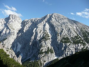 Kleiner (left) + Großer (right) Solstein from the N
 -
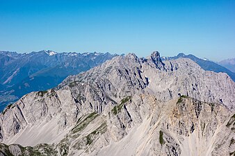 View of the Nordkette from the Stempeljochspitze. The Kleiner Solstein can be seen rising prominently


Literature
- Klier, Walter (1996), ISBN 3763311211
References
- ^ Geologische Karte von Bayern mit Erläuterungen (1:500,000). Bavarian State Geological Office, 1998.
External links
 Media related to Kleiner Solstein at Wikimedia Commons
- Tour description