
Kutschenberg
| Kutschenberg | |
|---|---|
 The Kutschenberg (centre) in the Kmehlener Berge | |
| Highest point | |
| Elevation | 201 m above sea level (NHN) (659 ft) [1] |
| Listing | highest hill in Brandenburg |
| Coordinates | 51°21′55″N 13°43′38″E / 51.36528°N 13.72722°E |
| Geography | |
| Location | near Großkmehlen; Oberspreewald-Lausitz, Brandenburg, Germany |
| Parent range | Kmehlener Berge |
| Geology | |
| Age of rock | 210,000 to 165,000 years ago |
| Mountain type | ice age terminal moraine |
| Type of rock | till of the Drenthe Stage of the Saale glaciation |
The Kutschenberg is the highest hill in Brandenburg, Germany. It is part of the low hill range of the Kmehlener Berge and rises near Großkmehlen in the county of Oberspreewald-Lausitz. It is 201 m above sea level (NHN)[1] and located only a few metres from the state border with Saxony.
Geography
Location
The Kutschenberg is 2.5 km west-southwest of Ortrand and 1.5 kilometres south of Großkmehlen not far from the A 13 motorway to the west and within a small area of woodland in the Kmehlener Berge.
Height
New surveys in 2000 discovered that the summit of the Kutschenberg was 201.0 m high
About 11 km to the west near Gröden is the Heidehöhe which, at 201.4 m, is slightly higher than the Kutschenberg, but is not the highest hill in Brandenburg, but its highest point, because the summit above it, the Heideberg, lies in Saxony. There is commonly held notion that the Hagelberg (200.24 m) on the Fläming Heath is the highest hill in Brandenburg, but the Kutschenberg is just a little higher.
Am Kutschenberg racetrack
On the northeast hillside of the Kutschenberg about 400 metres from the summit is the nationally known offroad racetrack of Am Kutschenberg, where car and motorcycle races are regularly held.[4]
Gallery
-
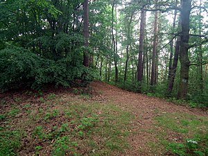
 Summit of the Kutschenberg
 -
 Summit stele on the Kutschenberg
 -
 Summit plateau of the Kutschenberg
 -
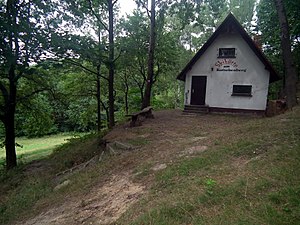 Skihütte am Kutschenberg
 -
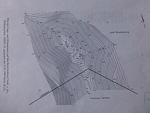 Plot des Lage- und Höhenplanes auf dem Kutschenberg


See also
References
- ^ a b c Photograph of the stele on the Kutschenberg with inscription at commons.wikimedia.org
- ^ Excerpt from: Heimatkundliches Jahrbuch für den Altkreis Bad Liebenwerda, das Mückenberger Ländchen, Ortrand am Schraden, Falkenberg und Uebigau 2002, p. 207 – Plot des Lage- und Höhenplanes auf dem Kutschenberg (reduction without scale; elevation reference system: DHHN 92, surveyed on 12 May 2000 by JR/JT), p. 210 – Schreiben zur Bestätigung der Messungen, signed by the Director of the Brandenburg State Survey Office. Published by the Working Group for Local History (Kreismuseum Bad Liebenwerda)
- Federal Agency for Nature Conservation
- ^ Autocross am Kutschenberg, at kutschenberg.de
|  | |