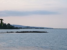
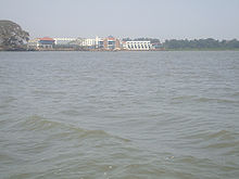
Lake Tana
| Lake Tana | ||
|---|---|---|
Primary inflows Gilgel Abay, Kilti River, Magech River, Reb River, Gumara River | | |
| Primary outflows | Blue Nile | |
| Basin countries | Ethiopia | |
| Max. length | 84 km (52 mi) | |
| Max. width | 66 km (41 mi) | |
| Surface area | 3,200 km2 (1,200 sq mi) | |
| Max. depth | 15 m (49 ft) | |
| Surface elevation | 1,788 m (5,866 ft) | |
| Islands | The most important are Tana Qirqos, Daga Island, Dek Island, and Mitraha | |
| Settlements | Bahir Dar, Gorgora | |
Lake Tana (
In 2015, the Lake Tana region was nominated as a
Overview


Lake Tana was formed by volcanic activity, blocking the course of inflowing rivers in the early Pleistocene epoch, about 5 million years ago.[5]
The lake was originally much larger than it is today. Seven large permanent rivers feed the lake as well as 40 small seasonal rivers. The main tributaries to the lake are Gilgel Abbay (Little Nile River), and the Megech, Gumara, and Rib rivers.[5]
Lake Tana has a number of islands, whose number varies depending on the level of the lake. It has fallen about 6 feet (1.8 m) in the last 400 years. According to
Remains of ancient Ethiopian emperors and treasures of the
The monasteries are believed to have been built during the Middle Ages over earlier religious sites. They include the fourteenth-century Debre Maryam, and the eighteenth-century Narga Selassie, Tana Qirqos (said to have housed the Ark of the Covenant before it was moved to Axum), and Ura Kidane Mehret, known for its regalia. A ferry service links Bahir Dar with Gorgora via Dek Island and various lakeshore villages.
There is also Zege Peninsula on the southwest portion of the lake. Zege is the site of the Azwa Maryam monastery.
Water characteristics and floods
Compared to other tropical lakes, the waters in Lake Tana are relatively cold, typically ranging from about 20 to 27 °C (68–81 °F). The water has a
Because of the large seasonal variations in the inflow of its tributaries, rain and evaporation, the water levels of Lake Tana typically vary by 2–2.5 m (6.6–8.2 ft) in a year, peaking in September–October just after the main wet season. When the water levels are high, the plains around the lake often are flooded and other permanent swamps in the region become connected to the lake.[9]
Fauna

Since there are no inflows that link the lake to other large waterways and the main outflow, the Blue Nile, is obstructed by the Blue Nile Falls, the lake supports a highly distinctive aquatic fauna, which generally is related to species from the Nile Basin.[10] The lake's nutrient levels are low.[9]
Fish
There are 27 fish species in Lake Tana and 20 of these are
In addition to the Labeobarbus species flock, the endemic species are
Fishing and threats
Lake Tana supports a large
Other serious threats are habitat destruction and pollution. Bahir Dar has become a large city and it is rapidly growing; its wastewater is generally released directly into the lake.[9] The vegetation in the lake's wetlands, which are an important nursery for the Labeobarbus and other fish, are being cleared at a fast pace. A potentially serious threat to the unique ecosystem would be an introduction of a large and efficient predatory species like the Nile perch, which has been implicated in numerous extinctions in Lake Victoria. The piscivorous Labeobarbus of Lake Tana are relatively inefficient predators that can only take fish up to about 15% of the length of the predator itself.[9]
Other fauna

Among other fauna, the lake supports relatively few invertebrates: There are fifteen species of
About 230 species of birds, including more than 80 wetland birds such as the
There are no
References
- ^ a b Garstin & Cana 1911.
- ^ Statistical Abstract of Ethiopia. 1967–68.
- ^ "Lake Tana, source of the Blue Nile". Observing the Earth. European Space Agency. 5 November 2004. Retrieved 4 November 2013.
- ^ Homepage of Lake Tana Biosphere Reserve
- ^ ISBN 978-1-4020-9725-6.
- ^ a b c C.F. Beckham and G.W.B. Huntingford, Some Records of Ethiopia, 1593-1646, (series 2, no. 107; London: Hakluyt Society, 1954), p. 35 and note.
- ^ Hayes, A.J. (1905). The Source of the Blue Nile: A Record of a Journey Through the Soudan to Lake Tsana in Western Abyssinia, and of the Return to Egypt by the Valley of the Atbara. Smith, Elder & Company. p. 73. Retrieved 2021-05-28.
- ISBN 978-0312227197
- ^ ISBN 978-1-4020-9725-6.
- ^ a b c d e Freshwater Ecoregions of the World (2008). Lake Tana. Archived 2011-10-05 at the Wayback Machine Accessed 24 January 2012
- ^ a b de Graaf, Dejen, Sibbing and Osse (2000). Barbus tanapelagius, A New Species from Lake Tana (Ethiopia): its Morphology and Ecology. Environmental Biology of Fishes 59 (1): 1-9.
- ^ de Graaf, Megens, Samallo, Sibbing (2007). Evolutionary origin of Lake Tana's (Ethiopia) small Barbus species: indications of rapid ecological divergence and speciation. Animal Biology 57(1): 39-48.
- ^ "Information on Fisheries Management in the Federal Democratic Republic of Ethiopia", Food and Agricultural Organization (FAO), January 2003
- ^ "The IUCN Red List of Threatened Species". IUCN. 2019. Retrieved 18 November 2019.
- ISBN 978-3-89973-466-9
External links
- Homepage of Lake Tana Biosphere Reserve
- Lake Tana project webpage of The Nature and Biodiversity Conservation Union (NABU e.V.)
- Lake Tana project Archived 2016-03-03 at the Wayback Machine at Aberystwyth University
- Photographs of the lake
- Unesco plan for Lake T'ana
- LakeNet Profile
- Pictures from Lake Tana and the Monasteries
- Garstin, William Edmund; Cana, Frank Richardson (1911). . In Chisholm, Hugh (ed.). Encyclopædia Britannica. Vol. 27 (11th ed.). Cambridge University Press. pp. 347–348.
