Llandenny
Llandenny
| |
|---|---|
 The Church of St John the Apostle and Evangelist, Llandenny (during the restoration of its roof) | |
Location within Monmouthshire | |
| OS grid reference | SO415038 |
| Principal area | |
| Preserved county | |
| Country | Wales |
| Sovereign state | United Kingdom |
| Post town | USK |
| Postcode district | NP15 |
| Dialling code | 01291 |
| Police | Gwent |
| Fire | South Wales |
| Ambulance | Welsh |
Monmouth | |
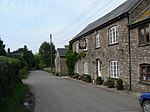
Llandenny (Welsh: Llandenni or, lesser used, Mathenni) is a village in Monmouthshire, south east Wales. Llandenny is located three miles south of Raglan and three miles north of Usk.[1]
History and amenities
The little village of Llandenny is just a few houses, a
A449
, passes close to the village.
The Raglan Arms was named for
Cefn Tilla Court until it was sold in 2015, following the death of Fitzroy Somerset
in 2010. A landlord of the pub in the 1930s was Frank Wake who catered nearly always for the farm labourers and not the gentry so it became a 'thorn in the flesh' of the Raglan family.
The nearby Llandenny railway station building (photographed) existed for many years until it was converted into a residential property. It included a ground frame signal box on the platform, a cattle dock and small goods sidings. It stood on the Coleford, Monmouth, Usk and Pontypool Railway line and closed in 1959.
Notes
- ^ "Llanddenni / Llandenny, Monmouthshire". The National Gazetteer of Great Britain and Ireland. genuki.org.uk. 1868. Retrieved 13 March 2012.
External links
![]() Media related to Llandenny at Wikimedia Commons
Media related to Llandenny at Wikimedia Commons


