
Marmora, New Jersey
Marmora, New Jersey | ||
|---|---|---|
Township Upper | | |
| Area | ||
| • Total | 2.02 sq mi (5.22 km2) | |
| • Land | 2.01 sq mi (5.20 km2) | |
| • Water | 0.01 sq mi (0.02 km2) | |
| Elevation | 23 ft (7 m) | |
| Population | ||
| • Total | 2,413 | |
| • Density | 1,201.69/sq mi (463.88/km2) | |
| ZIP Code | 08223 | |
| FIPS code | 34-44280[3] | |
| GNIS feature ID | 0878138[4] | |
Marmora is an
Metropolitan Statistical Area. Its postal ZIP Code
is 08223. Its 1990 population was approximately 4,420 persons.
A post office was established in 1890, with James Corson as the first postmaster.[7]
Demographics
As of the 2020 United States census, the population was 2,413.[2]
| Census | Pop. | Note | %± |
|---|---|---|---|
| 2020 | 2,413 | — | |
| U.S. Decennial Census[8] 2020[2] | |||
Education
Upper Township School District operates public schools for K-8. Upper Township Primary School and Upper Township Elementary School have Marmora addresses while Upper Township Middle School has a Petersburg address. Ocean City High School of Ocean City School District has high school students from Upper Township.
Countywide schools include Cape May County Technical High School and Cape May County Special Services School District.
The
Cape May Courthouse postal address.[10] It is the parish school of Marmora/Woodbine Catholic Church and three other churches.[11]
References
- ^ "ArcGIS REST Services Directory". United States Census Bureau. Retrieved October 11, 2022.
- ^ a b c Census Data Explorer: Marmora CDP, New Jersey, United States Census Bureau. Accessed June 15, 2023.
- ^ Geographic Codes Lookup for New Jersey, Missouri Census Data Center. Accessed June 9, 2023.
- ^ "Marmora". Geographic Names Information System. United States Geological Survey, United States Department of the Interior. Retrieved October 6, 2012.
- ^ State of New Jersey Census Designated Places - BVP20 - Data as of January 1, 2020, United States Census Bureau. Accessed December 1, 2022.
- ^ Locality Search, State of New Jersey. Accessed June 9, 2016.
- ^ Stevens, Lewis Townsend (1897). The History of Cape May County, New Jersey: From the Aboriginal Times to the Present Day. Star of the Cape Publishing Co. p. 469.
- ^ "Census of Population and Housing". Census.gov. Retrieved June 4, 2016.
- Press of Atlantic City. Retrieved September 14, 2020.
Bishop McHugh Regional Catholic School in the Ocean View section of Dennis Township
- ^ "Zoning Map" (PDF). Dennis Township. Retrieved September 14, 2020. - Compare to the address: "2221 Rt. 9 North, Cape May Court House, NJ 08210"
- ^ "About". Bishop McHugh Regional School. Retrieved September 14, 2020.
External links
Wikimedia Commons has media related to Marmora, New Jersey.
- Marmora: an interactive aerial perspective from Virtual Earth
- Marmora: another aerial perspective from Virtual Earth
- The Upper Township Gazette, local community newspaper
Municipalities and communities of Cape May County, New Jersey, United States | ||
|---|---|---|
| Cities | 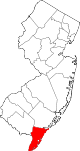 | |
| Boroughs | ||
| Townships | ||
| CDPs | ||
| Other communities |
| |
| ||
| International | |
|---|---|
| National | |
This Cape May County, New Jersey state location article is a stub. You can help Wikipedia by expanding it. |