
Mars Orbiter Laser Altimeter

The Mars Orbiter Laser Altimeter (MOLA) was one of five instruments on the Mars Global Surveyor (MGS) spacecraft, which operated in Mars orbit from September 1997 to November 2006. However, the MOLA instrument transmitted altimetry data only until June 2001. The MOLA instrument transmitted infrared laser pulses towards Mars at a rate of 10 times per second and measured the time of flight to determine the range (distance) of the MGS spacecraft to the Martian surface. The range measurements resulted in precise topographic maps of Mars. The precision maps are applicable to studies in geophysics, geology and atmospheric circulation. MOLA also functioned as a passive radiometer and measured the radiance of the surface of Mars at 1064 nanometers.[1]
Planetary laser altimetry
A
The distance to the object can be determined by multiplying the round-trip pulse time by the
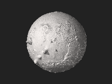
Pole-to-pole view


Above is a pole-to-pole view of Martian
See also
References
- ^ This article contains public domain material from NASA Goddard Flight Center web site."Planetary Laser Altimetry MOLA" (General description online). NASA Goddard Space Flight Center. Retrieved February 14, 2011.
- ^ This article contains public domain material from NASA Goddard Flight Center web site."Planetary Laser Altimetry" (General description). NASA Goddard Space Flight Center. Retrieved February 14, 2011.
- ^ "Planetary Laser Altimetry MOLA" (General description online). NASA Goddard Space Flight Center. Retrieved February 14, 2011.
- PMID 10348732. Free PDF download of this peer reviewed article.
- PMID 10348732. Retrieved February 14, 2011.
External links
- MOLA shot counter. Individual laser pulses shot by MOLA since launch (approximate).