
Marvyn, Alabama
Marvyn, Alabama | |
|---|---|
UTC-6 (EDT) | |
| GNIS feature ID | 122351[1] |
Marvyn, also spelled Marvin, is an
History
Marvyn was originally located in Russell County, but was granted to Lee County in 1923 in exchange for Phenix City. A soil series is named after Marvyn, as it was first described in the area. The Marvyn soil series is described as a "fine-loamy, siliceous, thermic Typic Hapludults.[2]
Geography
Marvyn is located at the junction of U.S. Route 80 and Alabama State Route 51 in the southern part of the county. Via US-80, Phenix City is 22 mi (35 km) east, and Tuskegee is 22 mi (35 km) west. Via AL-51, Opelika, the county seat of Lee County, is 15 mi (24 km) north, and Hurtsboro is 15 mi (24 km) south.
Demographics
| Census | Pop. | Note | %± |
|---|---|---|---|
| 1880 | 241 | — | |
| U.S. Decennial Census[3] | |||
Marvyn appeared on the U.S. Census in 1880 with a population of 241 residents. At the time it was located in Russell County. This was the only time it was listed on the census rolls as a separate community.
References
- ^ U.S. Geological Survey Geographic Names Information System: Marvyn, Alabama
- ISBN 978-0-412-06941-3.
- ^ "U.S. Decennial Census". Census.gov. Archived from the original on May 7, 2015. Retrieved June 6, 2013.
- Barnes, Margaret Anne (1998). The Tragedy and the Triumph of Phenix City, Alabama. Macon, Ga., Mercer University Press. ISBN 0-86554-613-4
External links
Municipalities and communities of Lee County, Alabama, United States | ||
|---|---|---|
| Cities | 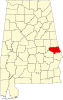 | |
| Towns | ||
| Unincorporated communities | ||
| Footnotes | ‡This populated place also has portions in an adjacent county or counties | |
| ||
| Central cities/largest cities |  Columbus, Georgia Metropolitan Statistical Area Auburn, Alabama Metropolitan Statistical Area Tuskegee, Alabama Micropolitan Statistical Area (defunct) | |
|---|---|---|
| Cities in Georgia | ||
| Cities in Alabama | ||
| Counties in Georgia | ||
| Counties in Alabama | ||
This Lee County, Alabama state location article is a stub. You can help Wikipedia by expanding it. |