
Matsatu Creek
| Matsatu Creek | |
|---|---|
 Mouth of Matsatu Creek | |
| Location | |
| Country | Canada |
| Province | British Columbia |
| District | Cassiar Land District |
| Physical characteristics | |
| Source | Level Mountain |
| • location | Nahlin Plateau |
| • coordinates | 58°29′56″N 131°25′16″W / 58.49889°N 131.42111°W[3] |
| • elevation | 1,700 m (5,600 ft)[2] |
| Mouth | Kakuchuya Creek |
• coordinates | 58°35′20″N 131°46′2″W / 58.58889°N 131.76722°W[1][2] |
• elevation | 940 m (3,080 ft)[2] |
| Length | 35 km (22 mi)[4] |
| Basin size | 912 km2 (352 sq mi)[5] |
| Discharge | |
| • average | 3.02 m3/s (107 cu ft/s)[5] |
| Basin features | |
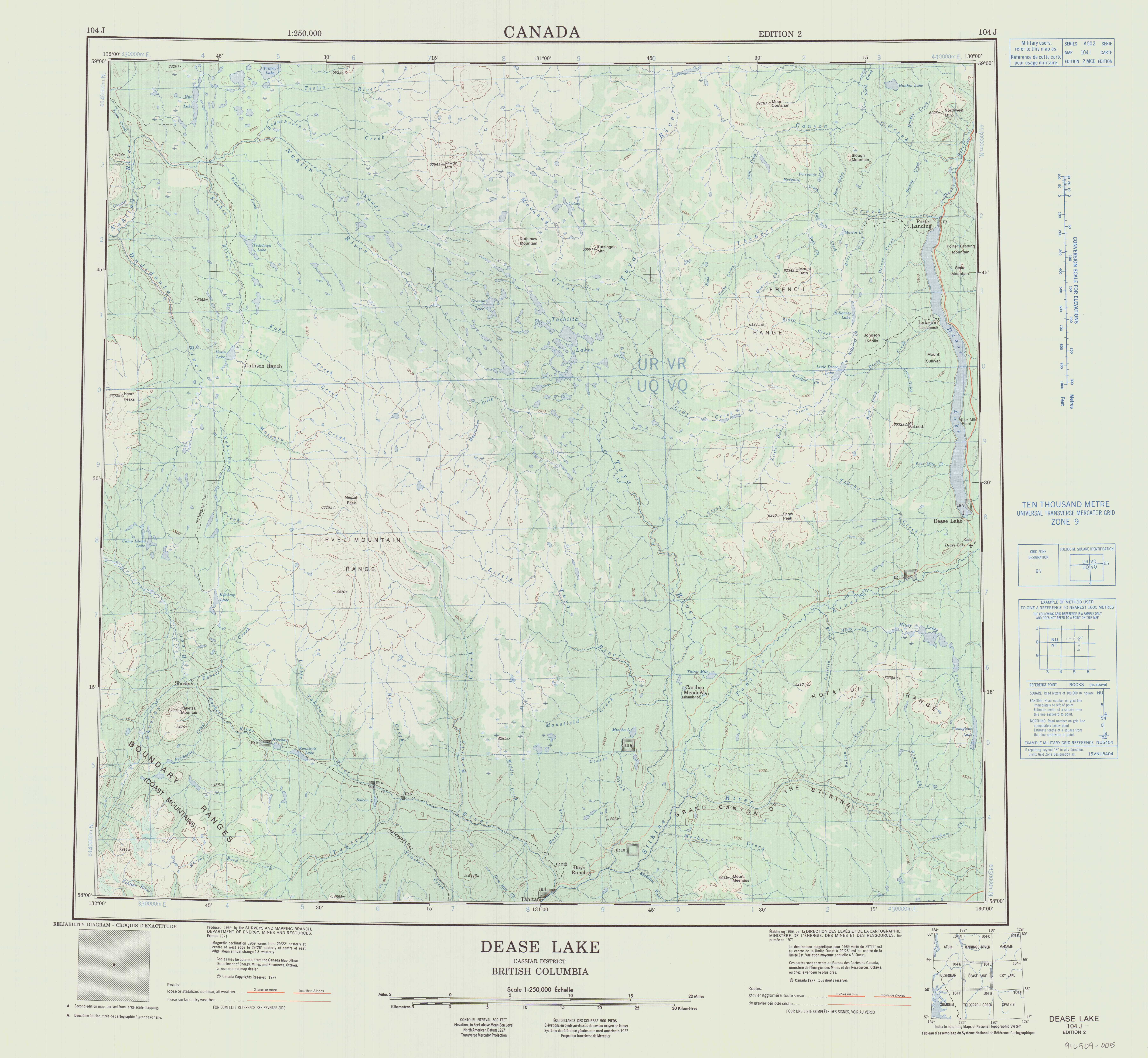
| Topo map | NTS 104J11 Granite Lake NTS 104J12 Dudidontu River |
Matsatu Creek, historically called the Matsatu River, is a tributary of Kakuchuya Creek and part of the Taku River watershed in northwest part of the province of British Columbia, Canada.[1][6] It is located 40 km (25 mi) north of the abandoned settlement of Sheslay in Cassiar Land District.
From its
Matsatu Creek's mean annual discharge is estimated at 3.02 m3/s (107 cu ft/s).[5] Its watershed covers 912 km2 (352 sq mi).[5] The watershed's land cover is classified as 52.7% barren, 28.6% shrubland, 10.1% conifer forest, 5.0% herbaceous, and small amounts of other cover.[5]
The mouth of Matsatu Creek is located about 85 km (53 mi) north of Telegraph Creek, British Columbia, about 105 km (65 mi) west of Dease Lake, British Columbia, and about 158 km (98 mi) east of Juneau, Alaska.
Matsatu Creek's watershed is within the traditional territory of the Tahltan First Nation, of the Tahltan people.[8][9]
Geography
Matsatu Creek originates on the slopes of Meszah Peak,[10] the highest peak of the Level Mountain Range, a cluster of bare peaks on the summit of the massive Level Mountain shield volcano, which forms the most voluminous and most persistent eruptive centre in the Northern Cordilleran Volcanic Province. The source of Matsatu Creek is close to the upper reach of the Koshin River and near the sources of the Little Tuya River, Kakuchuya Creek, and Beatty Creek.[2][11][12]
From its source Matsatu Creek flows north and west through a large gorge in the western escarpment of Level Mountain. As it continues flowing through the Nahlin Plateau, it collects numerous unnamed tributary streams. It flows just south of the headwaters of Lost Creek. Matsatu Creek joins Kakuchuya Creek about 1 km (0.62 mi) east from Kakuchuya Creek's confluence with the Dudidontu River.[2][11][12]
See also
References
- ^ a b "Matsatu Creek". BC Geographical Names.
- ^ a b c d e "Toporama (on-line map and search)". Atlas of Canada. Natural Resources Canada. Retrieved 4 October 2023.
- ^ Derived from BCGNIS, topographic maps, and Toporama
- ^ a b Length measured using BCGNIS coordinates, topographic maps, and Toporama
- ^ a b c d e f "Northwest Water Tool". BC Water Tool. GeoBC, Integrated Land Management Bureau, Ministry of Agriculture and Lands, Government of British Columbia. Retrieved 28 September 2023.
- ^ "Matsatu Creek". Geographical Names Data Base. Natural Resources Canada.
- ^ Annual Report of the Department of the Interior for the Year 1896 (Report). Ottawa, Ontario: Department of the Interior. 1897. p. 109.
- ^ "Our Territory". Tahltan Central Government. Retrieved 29 September 2023.
- ^ "Dah Ki Mi — "Our House"". Tahltan Band Council. Retrieved 29 September 2023.
- ^ "Meszah Peak". BC Geographical Names.
- ^ ISBN 978-1-926806-87-7. Retrieved 10 October 2023.
- ^ Department of Energy, Mines and Resources. 1977. Archived from the originalon 2021-05-02. Retrieved 2021-08-14.