
Mexican Federal Highway 180
 | ||||
|---|---|---|---|---|
| Carretera federal 180 | ||||
| Route information | ||||
| Maintained by Cancún, Quintana Roo | ||||
| West end | ||||
| Location | ||||
| Country | Mexico | |||
| Highway system | ||||
| ||||
Federal Highway 180 is a Mexican
Cancún, Quintana Roo, in the Yucatán Peninsula. Although the highway is numbered as a west-east route, it initially follows a north-south alignment through Tamaulipas and Veracruz
.
The highway is briefly interrupted from El Encinal to
Campeche into Mérida
, and finally east into Cancún.
Highway 180 connects at the Mexico–U.S. border with
U.S. Highways in the United States at 3,034 km (1,885 mi). Federal Highway 180 also connects with Interstate 69E/U.S. Route 77 at the border. U.S. Route 83 (along with Interstate 69E/U.S. Route 77) starts the northern terminus of Highway 180 in Brownsville, Texas, at the Veterans International Bridge on the border. After crossing the bridge into the United States, Federal Highway 180 continues as U.S. Route 83 in Brownsville which then runs northward to the U.S. highway's northern terminus, north of Westhope, North Dakota, at the Canada–United States border. From here, the highway continues further as Manitoba Highway 83 until it ends at Swan River, Manitoba
. In total, the three highways total 5,691 km (3,536 mi) in length.
Image gallery
-
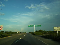 Heading towards Cancun from Mérida
 -
 Carretera Federal 180 looking northbound near Gutiérrez Zamora.


See also
References
- Secretaría de Comunicaciones y Transportes. 2011. pp. 1, 4, 15. Archived from the original(PDF) on 2012-05-14. Retrieved 2012-03-18.
- Secretaría de Comunicaciones y Transportes. 2011. p. 5. Archived from the original(PDF) on 2012-05-14. Retrieved 2012-03-18.
- Secretaría de Comunicaciones y Transportes. 2011. pp. 5, 7, 11–12. Archived from the original(PDF) on 2012-03-16. Retrieved 2012-03-18.
- Secretaría de Comunicaciones y Transportes. 2011. pp. 8, 12–14. Archived from the original(PDF) on 2012-05-14. Retrieved 2012-03-18.
External links
![]() Media related to Carretera Federal 180 at Wikimedia Commons
Media related to Carretera Federal 180 at Wikimedia Commons
| Highways |
|
|---|---|
| Toll roads | |
| Former highways | |
This article about the roads and road transport of Mexico is a stub. You can help Wikipedia by expanding it. |