
Mohawk Trail
Mohawk Trail | |
U.S. National Historic Site | |
 The Mohawk Trail, with Todd Mountain in the background | |
  | |
| Nearest city | Greenfield and North Adams, Massachusetts |
|---|---|
| Coordinates | 42°38′27″N 72°57′13″W / 42.64083°N 72.95361°W |
| Area | 2,275 acres (921 ha) |
| NRHP reference No. | 73000283 [1] |
| Added to NRHP | April 03, 1973 |
The Mohawk Trail began as a
Route
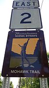
Today the Mohawk Trail is a part of Routes 2 and 2A, following much of the original Indian trail. The exact path of the trail are not officially defined, and there is some disagreement among various sources as to its endpoints. The broadest definition runs 75 miles (121 kilometers) from Athol, Massachusetts[2][3] to the border with New York in Williamstown, Massachusetts, passing through the communities of Orange, Erving, Gill, Greenfield, Shelburne, Buckland, Charlemont, Savoy, Florida, and North Adams. However, other sources use a narrower definition, with the eastern terminus being in Millers Falls,[4] Greenfield,[5] or Charlemont.[6] The trail is generally considered to follow Route 2A in the east (which diverges from Route 2 as it goes through the town centers of Athol, Orange, and Greenfield) and continue on Route 2 after Route 2A ends in Greenfield.[7]
Attractions
The modern day Mohawk Trail is considered one of the most beautiful drives in Massachusetts. The
A six-mile section of the Mohawk Trail was severely damaged by Hurricane Irene in August 2011. A considerable portion of the road is surrounded by the Mohawk Trail State Forest, a 6,400-acre (26 km2) forest, known for its camping, and occasional encounters with bobcats and black bears. Within this area there is substantial acreage of old growth forest containing many of the tallest trees in Massachusetts as verified by the Eastern Native Tree Society.[10] The route passes close to
A portion of the historic footpath route, running through Florida, Savoy, and Charlemont, from the confluence of the Cold and Deerfield Rivers up the Cold River valley to Wheeler Brook, was added to the National Register of Historic Places on April 3, 1973. This route, where the footpath itself is no longer extant in original form, is located on the north bank of the Cold River, with the modern roadway running along the south bank included in the listed area as an intrusion on the setting.[11]
Gallery
-
 Repair of Route 2 after a 6-mile washout along the Cold River caused by Hurricane Irene.
 -
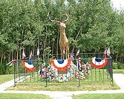 The Elk On The Trail, Whitcomb's Summit
 -
 Hail to the Sunrise, Charlemont
 -
 The Western Summit near the end of the Mohawk Trail, looking towards North Adams and theTaconic Range
 -
 Massachusetts Route 2 at the beginning of the Mohawk Trail, Williamstown
 -
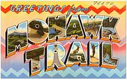 Tichnor Bros.large-letter postcard c. 1940


.jpg)


.jpg)
See also
References
- ^ "National Register Information System". National Register of Historic Places. National Park Service. March 13, 2009.
- ^ "Mohawk Trail Scenic Byway – MA". National Scenic Byway Foundation.
- ^ "Mohawk Trail East Scenic Byway Corridor Management Plan (2009)". Franklin Regional Council of Governments.
- ^ York, Lauren L. "The Highway of History: Celebrating Decades of Motorcar Travel". Mohawk Trail Region.
- ^ Button, Margaret (September 23, 2022). "8 stops along Massachusetts' Mohawk Trail worth a day trip". The Berkshire Eagle.
- ^ "Mohawk Trail (U.S. National Park Service)". www.nps.gov. Retrieved 2024-05-07.
- ^ "Mohawk Trail Scenic Byway Eastern Section - Athol to Greenfield: Corridor Map" (PDF). Franklin Regional Council of Governments.
- ^ The Berkshire Hills & Pioneer Valley - Chritina Tree & William Davis - Countryman Press 2011
- ^ "Truck Slides Off Road On Mohawk Trail in North Adams". www.iberkshires.com.
- ^ "Tall tree list".
- ^ NRHP nomination for Mohawk Trail. File Unit: National Register of Historic Places and National Historic Landmarks Program Records: Massachusetts, 1964 - 2012. National Archive. Retrieved 2017-12-11.
External links
- Mohawk Trail Region | The Mohawk Trail Association
- The Mohawk Trail Through The Berkshire Hills at the Wayback Machine (archived September 23, 2015)
- Mohawk Trail - Massachusetts Scenic Drives at the Wayback Machine (archived April 23, 2010)