Moose Wilson Road, Wyoming
Moose Wilson Road, Wyoming | ||
|---|---|---|
FIPS code 56-54402[1] | | |
| GNIS feature ID | 1853207[2] | |
Moose Wilson Road is a
Geography
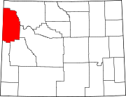
The Moose Wilson Road CDP has a southern boundary near 43°31′44″N 110°50′33″W / 43.52889°N 110.84250°W (43.528914, -110.842392).[4] It includes the Moose Wilson Road, the area around the Moose post office, private inholdings on the east side of the Snake River, and extends as far north as Shadow Mountain.
Demographics
| Census | Pop. | Note | %± |
|---|---|---|---|
| 2000 | 1,439 | — | |
| 2010 | 1,821 | 26.5% | |
| 2020 | 1,661 | −8.8% | |
| [5] | |||
As of the
There were 625 households, out of which 24.6% had children under the age of 18 living with them, 50.6% were married couples living together, 3.8% had a female householder with no husband present, and 43.7% were non-families. 28.0% of all households were made up of individuals, and 2.4% had someone living alone who was 65 years of age or older. The average household size was 2.30 and the average family size was 2.79.
In the CDP, the population was spread out, with 19.1% under the age of 18, 6.5% from 18 to 24, 34.3% from 25 to 44, 32.7% from 45 to 64, and 7.4% who were 65 years of age or older. The median age was 39 years. For every 100 females, there were 111.9 males. For every 100 females age 18 and over, there were 115.6 males.
The median income for a household in the CDP was $56,842, and the median income for a family was $114,552. Males had a median income of $43,750 versus $35,938 for females. The
Education
Public education in the community of Moose Wilson Road is provided by Teton County School District #1.
References
- ^ a b "U.S. Census website". United States Census Bureau. Retrieved January 31, 2008.
- ^ "US Board on Geographic Names". United States Geological Survey. October 25, 2007. Retrieved January 31, 2008.
- ^ "2020 Census Data". United States Census Bureau. Retrieved September 30, 2023.
- ^ "US Gazetteer files: 2010, 2000, and 1990". United States Census Bureau. February 12, 2011. Retrieved April 23, 2011.
- ^ "Historical Decennial Census Population for Wyoming Counties, Cities, and Towns". Wyoming Department of State. Retrieved September 1, 2011.