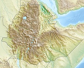
Mount Zuqualla
| Tulluu Cuqqaalaa | |
|---|---|
| Zuquala, Zikwala, Cuqqaalaa | |
 | |
| Highest point | |
| Elevation | 2,989 m (9,806 ft)[1] |
| Listing | Volcanoes of Ethiopia |
| Coordinates | 8°33′N 38°52′E / 8.550°N 38.867°E |
| Geography | |
| Geology | |
| Mountain type | Stratovolcano |
| Last eruption | Pleistocene[1] |
| Climbing | |
| Easiest route | Bole International Airport in Addis Ababa and Bishoftu |
 | |
Mount Zuqualla (also spelled Zuquala, Zikwala or Chuqqaala) is an
Ada'a Chukala woreda of the (East) Shewa Zone, it rises from the plain 30 kilometres (19 mi) south of Bishoftu. With a height of 2,989 metres (9,806 ft), it is known for its crater lake, lake Dembel, an elliptical crater lake with a maximum diameter of about one kilometre, but the trail around the crater is about 6 km long.[2]
History


Both the mountain and the lake is a holy site to the Oromo living nearby.[3] The ambivalent attitude regarding the holiness of the mountain is seen in the Oromo proverb: "Those who live far away worship it, those who live nearby plow it."
The lake in the crater has an island
rock formations, while the monastery is the site of a biannual festival
.
The explorers
1960 Ethiopian coup fled to Zuqualla from the capital, where the Moja family had land. Two of them lost their lives 24 December while Mengistu Neway, seriously wounded, was captured and brought to the capital for trial.[2]
References
- ^ a b "Zikwala". Global Volcanism Program. Smithsonian Institution. Retrieved 24 June 2021.
- ^ a b c Compiled by Bernhard Lindahl. "Local History in Ethiopia" (PDF). The Nordic Africa Institute. p. 4. Retrieved 11 February 2024.
- ISBN 9781850655220.
External links

