
Nashua, Montana
Nashua, Montana | ||
|---|---|---|
FIPS code 30-52900 | | |
| GNIS feature ID | 2413034[2] | |
Nashua is a town in
The town was established as a station on the St. Paul, Minneapolis & Manitoba Railway in 1888.[4] Nashua had a brief economic boom during the building of Fort Peck Dam in the 1930s.
Geography

According to the United States Census Bureau, the town has a total area of 0.66 square miles (1.71 km2), all land.[5]
Climate
According to the
Demographics
| Census | Pop. | Note | %± |
|---|---|---|---|
| 1920 | 272 | — | |
| 1930 | 351 | 29.0% | |
| 1940 | 943 | 168.7% | |
| 1950 | 691 | −26.7% | |
| 1960 | 796 | 15.2% | |
| 1970 | 513 | −35.6% | |
| 1980 | 495 | −3.5% | |
| 1990 | 375 | −24.2% | |
| 2000 | 325 | −13.3% | |
| 2010 | 290 | −10.8% | |
| 2020 | 301 | 3.8% | |
| U.S. Decennial Census[7][3] | |||
2010 census
As of the
There were 136 households, of which 23.5% had children under the age of 18 living with them, 50.0% were married couples living together, 6.6% had a female householder with no husband present, 5.9% had a male householder with no wife present, and 37.5% were non-families. 35.3% of all households were made up of individuals, and 14% had someone living alone who was 65 years of age or older. The average household size was 2.13 and the average family size was 2.66.
The median age in the town was 50.8 years. 19.7% of residents were under the age of 18; 4.4% were between the ages of 18 and 24; 18.9% were from 25 to 44; 35.4% were from 45 to 64; and 21.4% were 65 years of age or older. The gender makeup of the town was 53.1% male and 46.9% female.
2000 census
As of the
There were 166 households, out of which 15.1% had children under the age of 18 living with them, 50.0% were married couples living together, 1.2% had a female householder with no husband present, and 44.0% were non-families. 41.0% of all households were made up of individuals, and 21.7% had someone living alone who was 65 years of age or older. The average household size was 1.96 and the average family size was 2.61.
In the town, the population was spread out, with 14.8% under the age of 18, 6.2% from 18 to 24, 21.2% from 25 to 44, 32.0% from 45 to 64, and 25.8% who were 65 years of age or older. The median age was 49 years. For every 100 females there were 127.3 males. For every 100 females age 18 and over, there were 16.4 males.
The median income for a household in the town was $26,827, and the median income for a family was $35,000. Males had a median income of $26,250 versus $17,188 for females. The
Transportation
Amtrak’s Empire Builder, which operates between Seattle/Portland and Chicago, passes through the town on BNSF tracks, but makes no stop. The nearest station is located in Glasgow, 15 miles (24 km) to the west.
High school
Despite the small number of students in the town's high school (7-12 in a graduating class), basketball, track and field, volleyball, cheerleading as well as American football are accessible to all students because of cooperation with a neighboring high school. The school also offers the possibility of joining the Art Club or the FCCLA (Family, Career and Community Leaders of America) Club.[citation needed] Nashua High School's team name is the Porcupines.[10]
References
- ^ "ArcGIS REST Services Directory". United States Census Bureau. Retrieved September 5, 2022.
- ^ a b U.S. Geological Survey Geographic Names Information System: Nashua, Montana
- ^ a b "U.S. Census website". United States Census Bureau. Retrieved November 2, 2021.
- ^ "Nashua". Montana Place Names Companion. Montana Historical Society. Retrieved April 7, 2021.
- ^ "US Gazetteer files 2010". United States Census Bureau. Archived from the original on July 2, 2012. Retrieved December 18, 2012.
- ^ Climate Summary for Nashua, Montana
- ^ "Census of Population and Housing". Census.gov. Retrieved June 4, 2015.
- ^ "U.S. Census website". United States Census Bureau. Retrieved December 18, 2012.
- ^ "U.S. Census website". United States Census Bureau. Retrieved January 31, 2008.
- ^ "Member Schools". Montana High School Association. Retrieved April 19, 2021.
Municipalities and communities of Valley County, Montana, United States | ||
|---|---|---|
| City | 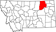 | |
| Towns | ||
| CDPs | ||
| Other communities | ||
| Indian reservations | ||
| Ghost towns | ||
| Footnotes | ‡This populated place also has portions in an adjacent county or counties | |
| ||