
Richland, Montana
Richland, Montana | ||
|---|---|---|
ZIP code 59260 | ||
| Area code | 406 | |
| GNIS feature ID | 775751[1] | |
Richland is an
The town had a post office from 1913 to 1919. In 1926, Richland moved about 15 miles southeast to a location along a branch line of the Great Northern Railway that extended from Flaxville to Opheim.[4]
References
- ^ "Richland". Geographic Names Information System. United States Geological Survey, United States Department of the Interior.
- ^ United States Postal Service (2012). "USPS - Look Up a ZIP Code". Retrieved February 15, 2012.
- ^ "Postmaster Finder - Post Offices by ZIP Code". United States Postal Service. Retrieved July 8, 2014.
- ^ "Richey". Montana Place Names Companion. Montana Historical Society. Retrieved April 9, 2021.
Municipalities and communities of Valley County, Montana, United States | ||
|---|---|---|
| City | 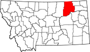 | |
| Towns | ||
| CDPs | ||
| Other communities | ||
| Indian reservations | ||
| Ghost towns | ||
| Footnotes | ‡This populated place also has portions in an adjacent county or counties | |
| ||
This Valley County, Montana state location article is a stub. You can help Wikipedia by expanding it. |