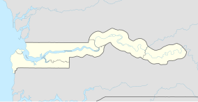
Niumi National Park
| Niumi National Park | |
|---|---|
| Location | The Gambia |
| Coordinates | 13°32′30″N 16°31′25″W / 13.54167°N 16.52361°W |
| Area | 4940 hectares |
| Established | 1987 |
| Designated | 13 October 2008 |
| Reference no. | 1840[1] |
Niumi National Park is a
Sine-Saloum Delta. It covers an area of approximately 4,940 ha (49.4 square km) and encompasses a range of types of wetlands and vegetation, from freshwater marsh to sand spits and brackish lagoons. Rhizophora mangrove forest is abundant in the park, and its swamp and mudflats are an important sheltering ground for birds, with over 200 species found here.[2]
Geography
Niumi National Park occupies the coastal strip in the southern tip of the
Sine-Saloum Delta. The park, which lies in the North Bank Region, is approximately 4,940 ha (49.4 square km) in extent. The Gambia declared its portion of the Delta as a national park in 1986.[3][4] In the north of the park, in the southern part of the delta is Jinack island and many small islands.[2]
Fauna and flora
Regionally, the park forms part of the Western Africa Marine ecoregion. It encompasses a range of types of wetlands and vegetation, from freshwater marsh to sand spits and brackish lagoons. Vervet Monkey (Cercopithecus aethiops), Spotted hyena (Crocuta crocuta), and warthog (Phacochoerus africanus).[2]
References
- ^ "Niumi National Park". Ramsar Sites Information Service. Retrieved 25 April 2018.
- ^ a b c "Information Sheet on Ramsar Wetlands (RIS)" (PDF). Ramsar.org. Retrieved 19 November 2016.
- ^ "Information Sheet on Ramsar Wetlands (RIS)" (PDF). Ramsar.org. Retrieved 19 November 2016.
- ^ "Niumi National Park". Thegambiawildlife.com. Retrieved 19 November 2016.

