
Ordesa y Monte Perdido National Park
| Ordesa and Monte Perdido National Park | |
|---|---|
| Parque Nacional de Ordesa y Monte Perdido | |
 | |
 Location of Ordesa y Monte Perdido | |
| Location | Pyrenees of Huesca, Spain |
| Nearest city | Jaca |
| Coordinates | 42°40′18″N 0°3′20″E / 42.67167°N 0.05556°E |
| Area | 156.08 km2 (60.26 sq mi) |
| Established | 1918 |
| Governing body | National Parks Autonomous Agency |
Europe and North America | |
| Extensions | 1999 |

Ordesa y Monte Perdido National Park (Parque nacional de Ordesa y Monte Perdido) is an
It has been included since 1997 by
Geology
The national park was created to protect the high mountain topography of
Climate
In general, the climate is typically Pyrenean, although the difference in altitude that goes from 750 meters at the entrance of the Añisclo canyon to 3,355 meters at Monte Perdido and the original orientation of each valley, means that there is an enormous climatic variety that It should be noted: the large variations in humidity and temperature between day and night. Thermal inversions that are reflected in the distribution of vegetation floors. Variable regime of valley and mountain winds.
Flora
At elevations up to 1,000–1,700 meters, there are extensive forests of beeches (
Fauna
The most important species of the Park was the bucardo or
Protected status
Many illustrious persons have been fond of the places in this region and have extolled their virtues. Luciano Briet, Soler i Santaló and Lucas Mallada helped promote the reputation of the region and obtain protected status for it.
An area of 21 square kilometres containing the Ordesa Valley was declared a National Park on 16 August 1918 by a Royal Decree. On 13 July 1982, it was enlarged to its current 156.08 square kilometres, and its official name was changed to Parque nacional de Ordesa y Monte Perdido.
Gallery
-
-
 North face ofLa Brèche de Roland
 -
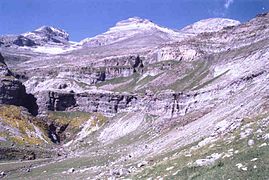
 Northwest face of Cirque of Soaso
 -
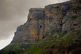
 Cirque de Cotatuero
 -
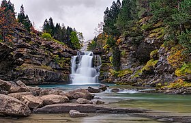
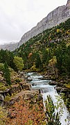 Arazas river fall, Ordesa valley
 -
 Entrance to the Ordesa Valley, Arazas river
 -
 Cirque of Soaso and Horse Tail (Cola del Caballo)
 -
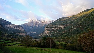 Entrance to Ordesa Valley from Torla
 -
 Punta Tobacor (2,779 m)
 -
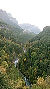
 Path inside the park, Ordesa valley
 -


Bibliography
- BENITO ALONSO, José Luis (2006). Vegetación del Parque Nacional de Ordesa y Monte Perdido (Sobrarbe, Pirineo central aragonés). 421 pp + Mapa de vegetación 1:40.000. ISBN 84-89862-54-0.
- BENITO ALONSO, José Luis (2006). Catálogo florístico del Parque Nacional de Ordesa y Monte Perdido (Sobrarbe, Pirineo central aragonés). ISBN 84-89943-88-5.
- BENITO ALONSO, José Luis (2014). Wild Flowers of Ordesa and Monte Perdido National Park (Spanish Pyrenees). Jolube Consultor Botánico y Editor, ISBN 9788494356162.
References
- ^ "Pyrenees-Mont Perdu". United Nations Environment Program - World Conservation Monitoring Centre. January 2000. Archived from the original on 2008-07-18. Retrieved 2008-08-12.
- ^ "Pyrénées - Mont Perdu". UNESCO World Heritage Centre. United Nations Educational, Scientific, and Cultural Organization. Retrieved 24 October 2021.
- ^ ISBN 978-94-017-8627-0.