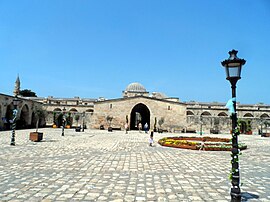
Payas
Payas | |
|---|---|
District and municipality | |
 | |
 Map showing Payas District in Hatay Province | |
| Coordinates: 36°45′N 36°13′E / 36.750°N 36.217°E | |
| Country | Turkey |
| Province | Hatay |
| Government | |
| • Mayor | Bekir Altan (AKP) |
| Area | 157 km2 (61 sq mi) |
| Elevation | 36 m (118 ft) |
| Population (2022)[1] | 43,919 |
| • Density | 280/km2 (720/sq mi) |
| Time zone | UTC+3 (TRT) |
| Area code | 0326 |
| Website | www |
Payas (
Geography
Payas is a Mediterranean coastal town. Distance to Dörtyol at the north is 12 kilometres (7.5 mi), to İskenderun at the south is 20 kilometres (12 mi) and to Antakya (the province center) is 84 kilometres (52 mi).
History
Payas and its vicinity have been inhabited throughout history. Ancient names of the town were Baias and Bayyas. During the
Following a period of short French occupation after the First World War, Payas became a part of Turkey[8] unlike most other parts of the Hatay Province, where French occupation continued till 1938, when the rest of Hatay was annexed by Turkey.
Composition
There are 12
- Çağlalık
- Cumhuriyet
- Fatih
- İstiklal
- Karacami
- Karbeyaz
- Karşı
- Kozludere
- Kürtül
- Sincan
- Yenişehir
- Yıldırım Beyazıt
Demographics
According to travellers Carl Humann and Otto Puchstein, during the 19th century, the town of Payas was inhabited by Turks and included 50 homes. The settlements in vicinity, though, also included Armenians but very few Alawites.[10]
Economy
Payas was an agricultural town in the early years of the Republic of Turkey. In the 1970s Payas became an industrial town with the establishment of the İskenderun Iron and Steel Factory. Today, the iron and steel factory within Payas is Turkey's second big iron-steel factory, and it contributes to Turkey's economy in great scales as well as the organized industry zone, coal enterprises and iron-producing mills. Because of this, 70 hot iron mills were established since 1970. Mills still provide much employment for people. The city receives immigrants due to the variety of employment opportunities also. The organized industrial zone has accrued with growing industrialization, and this zone has built on 100 hectares. Consequently, there are about 1100 workplaces in Payas. Some of them are transportation companies, and 700–800 trucks transport coal and iron to big factories in a day. Livestock and agriculture areas are limited, because of developed industry and trade. And there is a local fishery in Payas; there are about 70 fishermen.[11]
References
- ^ TÜİK. Retrieved 19 September 2023.
- ^ Büyükşehir İlçe Belediyesi, Turkey Civil Administration Departments Inventory. Retrieved 19 September 2023.
- ^ "İl ve İlçe Yüz ölçümleri". General Directorate of Mapping. Retrieved 19 September 2023.
- ^ "Law No. 6360". Official Gazette (in Turkish). 6 December 2012.
- ^ "İl İdaresi ve Mülki Bölümler Şube Müdürlüğü İstatistikleri - İl ve İlçe Kuruluş Tarihleri" (PDF) (in Turkish). p. 39. Retrieved 5 September 2023.
- ^ Photographs and a plan of the military architecture at Payas
- ISBN 0-88402-163-7.
- ^ Town page (in Turkish)
- ^ Mahalle, Turkey Civil Administration Departments Inventory. Retrieved 19 September 2023.
- ^ Humann, Carl; Puchstein, Otto (1890). Reisen in Kleinasien und Nordsyrien. Verlag nicht ermittelbar. p. 161.
Payas besteht heutzutage, wie gesagt, nur aus etwa 50 Hütten; die Einwohnern sind Türken. Dort residiert die Kaimmakam, zu dessen Bezirk die fünf genannten Dörfer nebst vielen andern im Gebirge gehören, im ganzen angeblich an 5000 Wohnungen, 1000 armenische, 4000 türkische; Ansarie gibt es nur wenige.
- ^ "Mayor's page" (in Turkish). Archived from the original on 2010-04-27. Retrieved 2010-06-09.

