
Pingjum
Pingjum
Penjum | ||
|---|---|---|
Village | ||
 St Victory Church | ||
|
Postal code 8749[1] | ||
| Dialing code | 0517 | |
Pingjum (
History
The village was first mentioned in the 13th century as Penningem, and means "settlement of Penne (person)".[4] Pingjum is a terp (artificial living hill) village from the early middle ages which developed on the Marneslenk in a grid structure.[5] According to legend, the earliest settlers were shepherds from Drenthe who decided to build the terps and around 1100 added dikes for further protection against the sea.[6]
The tower of the Dutch Reformed church was built in the 12th or 13th century and was enlarged in the 15th century. The church dates from around 1500 and was enlarged in 1759. A water well is located next to the choir.[5]
In 1524,
During the February flood of 1825, Frisian seawalls broke. Pingjum was spared thanks to a dike around the village known as the Pingjumer Golden Collar (Pingjumer Gulden Halsband). In 1892 the province of Friesland decided to put an end to the Pingjumer Golden Collar coastal protection, although in several places the dike is still visible.[8] This ring dyke was originally built in part to reclaim land from the Marne Estuary to the north of the village.[9]
Pingjum was home to 116 people in 1840.[6] Part of the terp was excavated.[10]
In 1945, the village was severely damaged.[5] On 15 April 1945, Canadian troops demanded the surrender of the German forces in the area. The Germans refused and hid in Pingjum. An intense two day battle with mortars and flame-throwers followed. On 17 April, the last farms in which the Germans were hiding, were set on fire.[7]: 6
Before 2011, the village was part of the Wûnseradiel municipality.[6]
Notable residents
- Obbe Sikkes Bangma (1768–1829), mathematician
- Rients Gratama, comedian
- Jan Ykema, Olympic speedskating medallist, lives in Pingjum
Gallery
-
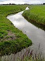 The Pingjumer Golden Collar southwest of Pingjum in 2011
 -
 Houses in Pingjum
 -
 View on Pingjum
 -
 Destruction during World War II (18 April 1945)


References
- ^ a b c "Kerncijfers wijken en buurten 2021". Central Bureau of Statistics. Retrieved 6 April 2022.
two entries
- ^ "Postcodetool for 8749GA". Actueel Hoogtebestand Nederland (in Dutch). Het Waterschapshuis. 24 July 2019. Retrieved 6 April 2022.
- ^ Kerncijfers wijken en buurten 2017 – CBS Statline
- ^ "Pingjum - (geografische naam)". Etymologiebank (in Dutch). Retrieved 6 April 2022.
- ^ ISBN 90-400-9476-4. Retrieved 6 April 2022.
- ^ a b c "Pingjum". Plaatsengids (in Dutch). Retrieved 6 April 2022.
- ^ a b "Dorpsvisie Pingjum 2012-2020" (PDF). Dorp Pingjum (in Dutch). 2012. Retrieved 6 April 2022.
- ^ "Home". dorppingjum.nl.
- ^ Spek, Theo (2 September 2017). "De Marneslenk Het kustlandschap van zuidelijk Westergo door de eeuwen heen" (PDF). Retrieved 22 March 2018.
- ^ "Pingjum". Friesland wonderland (in Dutch). Retrieved 6 April 2022.
External links
![]() Media related to Pingjum at Wikimedia Commons
Media related to Pingjum at Wikimedia Commons