
Port Barre, Louisiana
Port Barre, Louisiana | ||
|---|---|---|
Town | ||
| Town of Port Barre | ||
ZIP code 70577 | ||
| Area code | 337 | |
| FIPS code | 22-61825 | |
| Website | https://www.townofportbarre.com | |
Port Barre (BAH-ree) is a
History
Port Barre takes its name from Alex Charles Barre (born 1746, died 1829); it was not incorporated under this name until 1898.
In 1733, the semi-nomadic
In 1765, Jacques Courtableau, a wealthy landowner, gave land grants to 32 Acadian immigrants. That same year, he sold a large parcel of land, including the site of the first trading post, to Charles Barre. The post later became known as Barre's Landing, then Port Barre. It thrived as a port town before the days of the railroads.[2][3]
Alex Charles Barre is a descendant of Guillaume Barre, born 1642 in St. Valery, France. He emigrated, settling about 1665 at Martinique in the French West Indies. There Guillaume Barre met Jean Roy (1625–1707) and Jean Hebert (1624), and they traveled together to Louisiana.
The Barres settled in
In 1820, Charles Alex Barre purchased additional acres from Sieur Jacques Guillaume Courtableau along the bank of the bayou, where the Barre family operated a goods handling business. The Barre, Nezat, and Roy families settled in this area and expanded. The settlement continued to grow through the 19th century. On July 13, 1898, the village of Port Barre was officially incorporated by Act of Proclamation of Louisiana Governor Jared Y. Sanders, Sr.[3]
Geography
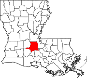
Port Barre is located 8 miles east of Opelousas, and 52 miles west of Baton Rouge via U.S. Highway 190 at the confluence of Bayou Courtableau and Bayou Teche.
According to the United States Census Bureau, the town has a total area of 1.1 square miles (2.8 km2), all land.
Demographics
| Census | Pop. | Note | %± |
|---|---|---|---|
| 1920 | 588 | — | |
| 1930 | 674 | 14.6% | |
| 1940 | 850 | 26.1% | |
| 1950 | 1,066 | 25.4% | |
| 1960 | 1,876 | 76.0% | |
| 1970 | 2,133 | 13.7% | |
| 1980 | 2,625 | 23.1% | |
| 1990 | 2,144 | −18.3% | |
| 2000 | 2,287 | 6.7% | |
| 2010 | 2,055 | −10.1% | |
| 2020 | 1,751 | −14.8% | |
| U.S. Decennial Census[4] | |||
2020 census
| Race | Number | Percentage |
|---|---|---|
White (non-Hispanic)
|
1,137 | 64.93% |
Black or African American (non-Hispanic)
|
528 | 30.15% |
Native American
|
1 | 0.06% |
Asian
|
3 | 0.17% |
Other/Mixed
|
56 | 3.2% |
Latino
|
26 | 1.48% |
As of the 2020 United States census, there were 1,751 people, 680 households, and 469 families residing in the town.
2010 census
As of the
2000 census
As of the
There were 867 households, out of which 36.8% had children under the age of 18 living with them, 50.9% were married couples living together, 17.1% had a female householder with no husband present, and 27.9% were non-families. 24.6% of all households were made up of individuals, and 10.8% had someone living alone who was 65 years of age or older. The average household size was 2.64 and the average family size was 3.16.
In the town, the population was spread out, with 29.8% under the age of 18, 9.6% from 18 to 24, 27.7% from 25 to 44, 20.9% from 45 to 64, and 12.1% who were 65 years of age or older. The median age was 34 years. For every 100 females, there were 93.0 males. For every 100 females age 18 and over, there were 86.8 males.
The median income for a household in the town was $23,945, and the median income for a family was $29,279. Males had a median income of $30,761 versus $19,000 for females. The
Arts and culture
Port Barre hosts an annual "Cracklin' Festival," held the second weekend in November. The Cracklin' Festival was started in 1986[7] by the Port Barre Lions Club. This large event is recognized by the state of Louisiana. All proceeds from the festival are donated to underprivileged children who need glasses or eye surgery.
Infrastructure
Transportation
| U.S. Route 190 is a major east-west route connecting with Baton Rouge to the east and with Opelousas and Eunice to the west. | |
| LA 103 is a state highway traveling northeast-southwest through the heart of the town, connecting with U.S. Route 190 (southeast) and extending northeast out of the corporation limits. | |
LA 741 is a state highway traveling northwest-southeast which connects with LA 103 (northwest) in town and extending southeast out of the corporation limits intersecting with U.S. Route 190.
|
Notable people
- Clay Higgins, member of the United States House of Representatives for Louisiana's 3rd congressional district
References
- ^ "2020 U.S. Gazetteer Files". United States Census Bureau. Retrieved March 20, 2022.
- ^ "Port Barre". Louisiana Office of Tourism. Retrieved June 28, 2014.
- ^ a b "Town History". Town of Port Barre. Archived from the original on July 2, 2014. Retrieved June 28, 2014.
- ^ "Census of Population and Housing". Census.gov. Retrieved June 4, 2015.
- ^ "Explore Census Data". data.census.gov. Retrieved December 29, 2021.
- ^ "U.S. Census website". United States Census Bureau. Retrieved January 31, 2008.
- ISBN 9780762769773.
External links
 | ||||
Towns | ||||
Villages | ||||
| CDPs | ||||
| Other communities |
| |||
| Footnotes | ‡This populated place also has portions in an adjacent parish or parishes | |||
| ||||
| International | |
|---|---|
| National | |