
Puerto Rico Highway 29
Highway 29 | ||||
|---|---|---|---|---|
| Ruta 29 | ||||
| Avenida Main Oeste | ||||
| Route information | ||||
| Maintained by Puerto Rico DTPW | ||||
| Length | 3.5 km[1] (2.2 mi) | |||
| Major junctions | ||||
| West end | ||||
| East end | ||||
| Location | ||||
| Country | United States | |||
| Territory | Puerto Rico | |||
| Municipalities | Bayamón | |||
| Highway system | ||||
| ||||

Puerto Rico Highway 29 (PR-29) is an avenue in the city of
Bayamón, Puerto Rico. It connects from the PR-2 (in Hato Tejas) to the PR-5, intersects the PR-167 at Plaza del Sol (a major commercial centers of Bayamón).[2] This road is called Avenida Main Oeste.[3]
- Puerto Rico Highway 29
-
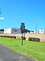
 Western terminus at PR-2 junction in Hato Tejas barrio, looking north
 -
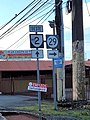
 Westbound sign in Juan Sánchez barrio
.jpg)
.jpg)
Major intersections
The entire route is located in Bayamón.
-
 PR-2 west at PR-29 intersection in Hato Tejas
 -
 PR-29 west near PR-871 intersection in Hato Tejas
 -
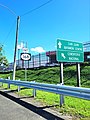 PR-29 east near PR-168 junction in Hato Tejas


.jpg)
| Location | km[1] | mi | Destinations | Notes | |
|---|---|---|---|---|---|
Hato Tejas | 0.0 | 0.0 | Western terminus of PR-29 | ||
| 0.2– 0.3 | 0.12– 0.19 | ||||
| 0.6– 0.7 | 0.37– 0.43 | Sabana Seca | |||
| 1.0– 1.1 | 0.62– 0.68 | ||||
| 1.7 | 1.1 | PR-Avenida Gilberto Concepción de Gracia – Sierra Bayamón | |||
| 2.7 | 1.7 | Bayamón Centro, Levittown | |||
Bayamón Centro | |||||
| 3.5 | 2.2 | trumpet interchange | |||
| 1.000 mi = 1.609 km; 1.000 km = 0.621 mi | |||||
See also
 Puerto Rico portal
 U.S. Roads portal
References
- ^ a b Google (28 February 2020). "PR-29" (Map). Google Maps. Google. Retrieved 28 February 2020.
- ^ Puerto Rico Department of Transportation and Public Works. "Datos de Transito 2000-2009" (in Spanish). Archived from the original on 1 April 2019. Retrieved 29 March 2019.
- OCLC 756511572.
External links
 Media related to Puerto Rico Highway 29 at Wikimedia Commons
This Bayamón, Puerto Rico location article is a stub. You can help Wikipedia by expanding it. |
This Puerto Rico road-related article is a stub. You can help Wikipedia by expanding it. |