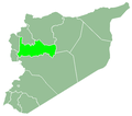
Qabr Fidda
Appearance
Qabr Fiddah
قبر فضة | |
|---|---|
Village | |
UTC+3 (EEST ) | |
| City Qrya Pcode | C3208 |
Qabr Fiddah (
Sunni Muslims.[2]
The village suffered substantial physical destruction during the Syrian Civil War and all of its residents were displaced, most of them becoming IDPs in the Idlib and Latakia Governorates. People began returning after the conflict, with a total of 360 returnees living in the village as of 21 April 2025.[3][4][5]
References
- ^ "General Census of Population 2004". Retrieved 2014-07-10.
- ^ Rockwood, Bill. "Interactive Map: A Valley at War". PBS Frontline.
- ^ Xinhua (20 June 2025). "Feature: After 14 years, Syrian refugees return home to rebuild life on dust and dreams". Big News Network. Retrieved 26 June 2025.
- ^ "Syrian Arab Republic — Baseline Assessment — Round 1 (Feb 2025) | Displacement Tracking Matrix". dtm.iom.int. Retrieved 2025-06-26.
- ^ "Syrian Arab Republic — Population Mobility and Baseline Assessment — Round 4 (May 2025) | Displacement Tracking Matrix". dtm.iom.int. Retrieved 2025-06-26.


