
Quebec Route 218
| ||||
|---|---|---|---|---|
| Location | ||||
| Country | Canada | |||
| Province | Quebec | |||
| Highway system | ||||
| ||||
Route 218 is a two-lane east/west highway in
Saint-Michel-de-Bellechasse at the junction of Route 281
.
Route description
From Saint-Pierre-les-Becquets to its junction with
Boyer River toward Saint-Charles-de-Bellechasse and its terminus just south of Autoroute 20
.
-
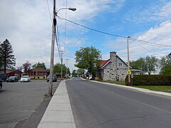 Route 218 in Notre-Dame-de-Lourdes.
 -
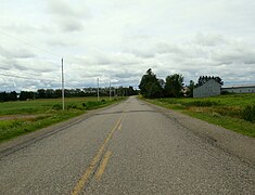
 Route 218 shares its itinerary with Route 271 through Sainte-Agathe-de-Lotbinière.
 -
 Route 218 follows Gosford Road in Sainte-Agathe.
 -
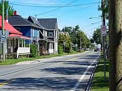
 Route 218 shares its itinerary with Route 269 through Saint-Gilles.
 -
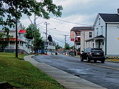
 Route 218 between Saint-Gilles and Saint-Lambert.
 -
 Pont street in Saint-Lambert, is marked as Route 218.
 -
 Bridge over Etchemin River in Saint-Henri.


.jpg)
.jpg)


Municipalities along Route 218
- Saint-Pierre-les-Becquets
- Sainte-Cécile-de-Lévrard
- Sainte-Sophie-de-Lévrard
- Manseau
- Notre-Dame-de-Lourdes
- Lyster
- Sainte-Agathe-de-Lotbinière
- Saint-Gilles
- Saint-Lambert-de-Lauzon
- Saint-Henri-de-Lévis
- Saint-Charles-de-Bellechasse
- Saint-Michel-de-Bellechasse
See also
References
- ^ Ministère des transports, "Distances routières", page 83, Les Publications du Québec, 2005
External links
- Provincial Route Map (Courtesy of the Quebec Ministry of Transportation) (in French)
- Route 218 on Google Maps