
Rosendale, Wisconsin
Rosendale, Wisconsin | ||
|---|---|---|
FIPS code 55-69550[5] | | |
| GNIS feature ID | 1572611[2] | |
| Website | villageofrosendale | |
Rosendale is a village in
History
The village was named for the wild rose bushes growing in a dale near the original town site.[6]
Geography
Rosendale is located at 43°48′34″N 88°40′23″W / 43.80944°N 88.67306°W (43.80962, -88.673154).[7]
According to the United States Census Bureau, the village has a total area of 1.22 square miles (3.16 km2), all of it land.[8]
Demographics
| Census | Pop. | Note | %± |
|---|---|---|---|
| 1920 | 305 | — | |
| 1930 | 305 | 0.0% | |
| 1940 | 317 | 3.9% | |
| 1950 | 388 | 22.4% | |
| 1960 | 415 | 7.0% | |
| 1970 | 464 | 11.8% | |
| 1980 | 725 | 56.3% | |
| 1990 | 777 | 7.2% | |
| 2000 | 923 | 18.8% | |
| 2010 | 1,063 | 15.2% | |
| 2019 (est.) | 1,031 | [4] | −3.0% |
| U.S. Decennial Census[9] | |||
2010 census
As of the
There were 407 households, of which 36.9% had children under the age of 18 living with them, 61.4% were married couples living together, 8.4% had a female householder with no husband present, 3.7% had a male householder with no wife present, and 26.5% were non-families. 21.4% of all households were made up of individuals, and 11.5% had someone living alone who was 65 years of age or older. The average household size was 2.61 and the average family size was 3.07.
The median age in the village was 36.6 years. 27.8% of residents were under the age of 18; 6.8% were between the ages of 18 and 24; 27.9% were from 25 to 44; 25.6% were from 45 to 64; and 12% were 65 years of age or older. The gender makeup of the village was 48.5% male and 51.5% female.
2000 census
As of the
of any race.There were 325 households, out of which 42.2% had children under the age of 18 living with them, 71.1% were married couples living together, 6.5% had a female householder with no husband present, and 19.4% were non-families. 13.8% of all households were made up of individuals, and 7.4% had someone living alone who was 65 years of age or older. The average household size was 2.84 and the average family size was 3.15.
In the village, the population was spread out, with 29.4% under the age of 18, 9.1% from 18 to 24, 30.3% from 25 to 44, 22.5% from 45 to 64, and 8.7% who were 65 years of age or older. The median age was 34 years. For every 100 females, there were 94.7 males. For every 100 females age 18 and over, there were 97.6 males.
The median income for a household in the village was $52,448, and the median income for a family was $57,083. Males had a median income of $38,125 versus $26,250 for females. The
Transportation
Rosendale is located along Highways
Rosendale has a reputation of being a
National Register of Historic Places listings


Rosendale is home to Sisson's Peony Gardens, listed on the National Register of Historic Places. Open for public viewing, the gardens hold an annual Peony Sunday in early June.
The Rosendale Historical Society headquarters on Main Street has been used for a museum since 2001. It is housed in the former Independent Order of Odd Fellows Lodge No. 89 which was added to the National Register in 2016. The society houses collections about the history of the village and surrounding areas.
Images
-
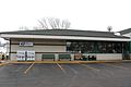 Post office
 -
 Looking west at the DOT Rosendale welcome sign
 -
 Fire Department
 -
 Welcome sign


References
- ^ "2019 U.S. Gazetteer Files". United States Census Bureau. Retrieved August 7, 2020.
- ^ a b "US Board on Geographic Names". United States Geological Survey. October 25, 2007. Retrieved January 31, 2008.
- ^ a b "U.S. Census website". United States Census Bureau. Retrieved November 18, 2012.
- ^ a b "Population and Housing Unit Estimates". United States Census Bureau. May 24, 2020. Retrieved May 27, 2020.
- ^ a b "U.S. Census website". United States Census Bureau. Retrieved January 31, 2008.
- ^ Chicago and North Western Railway Company (1908). A History of the Origin of the Place Names Connected with the Chicago & North Western and Chicago, St. Paul, Minneapolis & Omaha Railways. p. 120.
- ^ "US Gazetteer files: 2010, 2000, and 1990". United States Census Bureau. February 12, 2011. Retrieved April 23, 2011.
- ^ "US Gazetteer files 2010". United States Census Bureau. Archived from the original on January 25, 2012. Retrieved November 18, 2012.
- ^ "Census of Population and Housing". Census.gov. Retrieved June 4, 2015.
- ^ SUSAN LAMPERT SMITH (August 11, 2002). "Beware of Rosendale, but buy a T-shirt when you get there https://encrypted-tbn0.gstatic.com/images?q=tbn:ANd9GcQk7PaIf4Qivcr8tmmatBLihGY03CXRlareWw&usqp=CAU". La Crosse Tribune.
{{cite news}}: External link in|title= - ^ Aaron Becker (October 9, 2013). "Aaron Rodgers & Rosendale are 'Just the Ticket'". Ripon News.
- Milwaukee Journal-Sentinel.
- Janesville Gazette.
External links
 | ||||
Villages | ||||
Towns | ||||
| CDPs | ||||
| Other communities |
| |||
| Former communities | ||||
| Footnotes | ‡This populated place also has portions in an adjacent county or counties | |||
| ||||
| Authority control databases: Geographic |
|---|