
Saint Bernard, Louisiana
Saint Bernard
San Bernardo ( St. Bernard Parish | |
|---|---|
| MCD | District E
|
ZIP code | 70085 |
| Area code | 504 |
| GNIS feature ID | 1628099 |
Saint Bernard (
Louisiana State Highway 300, east of the Mississippi River and 8 miles (13 km) southeast of Chalmette
.
Saint Bernard is home to four sites on the National Register of Historic Places: the Dr. Louis A. Ducros House, the Kenilworth Plantation House, Magnolia Mound, and the Sebastopol Plantation House.[1]
References
| CDPs | 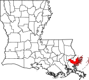 | |
|---|---|---|
| Other communities | ||
| Ghost towns | ||
| ||
This Louisiana state location article is a stub. You can help Wikipedia by expanding it. |