
Meraux, Louisiana
Meraux | ||
|---|---|---|
Census-designated place | ||
ZIP code 70075[2] | ||
| Area code | 504 | |
| FIPS code | 22-49800 | |
Meraux is a census-designated place (CDP) in St. Bernard Parish, Louisiana, United States. The population was 6,804 in 2020. It is part of the New Orleans–Metairie–Kenner Metropolitan Statistical Area.
History
In 2005, the town was devastated by storm surge and wind associated with

Geography
Meraux is located at 29°55′39″N 89°55′7″W / 29.92750°N 89.91861°W (29.927561, -89.918508).[3] According to the United States Census Bureau, the CDP has a total area of 4.8 square miles (12.4 km2), of which 4.2 square miles (10.8 km2) is land and 0.6 square mile (1.6 km2) (12.94%) is water.
Demographics
| Census | Pop. | Note | %± |
|---|---|---|---|
| 2020 | 6,804 | — | |
| U.S. Decennial Census[4] | |||
| Race | Number | Percentage |
|---|---|---|
White (non-Hispanic)
|
4,427 | 65.06% |
Black or African American (non-Hispanic)
|
1,005 | 14.77% |
Native American
|
40 | 0.59% |
Asian
|
152 | 2.23% |
Other/Mixed
|
308 | 4.53% |
Latino
|
872 | 12.82% |
In 2000,
Education
Residents are zoned to schools in the St. Bernard Parish Public Schools.
As of 2007, Chalmette High School serves the population.
References
- ^ "2020 U.S. Gazetteer Files". United States Census Bureau. Retrieved March 20, 2022.
- ^ "Meraux LA ZIP Code". zipdatamaps.com. 2023. Retrieved June 16, 2023.
- ^ "US Gazetteer files: 2010, 2000, and 1990". United States Census Bureau. February 12, 2011. Retrieved April 23, 2011.
- ^ "Census of Population and Housing". Census.gov. Retrieved June 4, 2016.
- ^ "Explore Census Data". data.census.gov. Retrieved December 28, 2021.
- ^ "U.S. Census website". United States Census Bureau. Retrieved January 31, 2008.
External links
| CDPs | 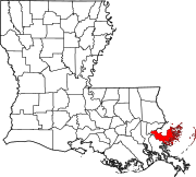 | |
|---|---|---|
| Other communities | ||
| Ghost towns | ||
| ||