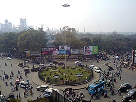
Sakchi
Sakchi | |
|---|---|
Neighbourhood of Jamshedpur | |
| Sakchi | |
 | |
| Coordinates: 22°48′19″N 86°12′08″E / 22.805182°N 86.202282°E | |
| Country | India |
| City | Jamshedpur |
| State | Jharkhand |
| Time zone | GMT + 0530 |
Sakchi was a village in north eastern Indian territory of Singhbhum which was selected by Jamsetji Tata to be the location of a planned steel city, which in 1919 became Jamshedpur.[1] Sakchi is now part of the city between the Tata Steel site and the river Subarnarekha. Then it was known as Kalimati.[2] Due to the presence of iron ore, river water and sand, Jamsetji Tata decided to establish TISCO (Tata Iron and Steel Company Limited) there. The company is now known as Tata Steel Ltd.[3]
Overview


2miles
Khasmahal
River
River
Hospital
Sports Complex
Zoological Park
Junction
railway station
of Technology
Metallurgical
Laboratory
Industrial Area
Motors
works
M: municipal town, F: facility, N: neighbourhood, W: works, factory, C: educational/ research centre
Owing to space constraints in the small map, the actual locations in a larger map may vary slightly
Places marked on this map, which have a separate page, are linked in the larger full scale map.
For map of Jamshedpur Urban Agglomeration see Mango or Adityapur page.
Even today running through Sakchi is the Kalimati Road. During
As
Once, there used to be a single line railway track which would carry sand for the factory in present-day Aambagan Maidan near the Masjid, it does not exist anymore. Mode of transport in the Jamshedpur city were buggies and taxis. There were single lane roads with old British style street lamps. Most roads between Sakchi and Bistupur were surrounded by jungles.
The city is unique because it is a very small town even today with extreme ends being covered within 45 minutes (including traffic). It is not a metro city, yet it has the demography of a metro town as people from all ethnicities live here as permanent residents. Sakchi is located in the centre of the city, with
.Sakchi today has numerous cinema halls, Sakchi Bazaar which holds Mangla Market (Tuesday market) every Tuesday on footpath. Sakchi Market (or Sakchi Bazaar) is the oldest market in the city.
History
In April 1904,
The construction of the plant began in 1908, the plant rolled its first steel ingot on 16 February 1912. In 1919,
Civic administration
There is a police station at Sakchi.[7]
References
- ^ "History of Jamshedpur, Facts About Jamshedpur, Jamshedpur History". www.jamshedpuronline.in. Retrieved 16 April 2023.
- ^ "It's been a long journey". www.telegraphindia.com. Retrieved 16 April 2023.
- ^ News, India TV. "Sakchi Pin Code | Postal Code (Zip Code) of Sakchi, East Singhbhum, Jharkhand, India". www.indiatvnews.com. Retrieved 16 April 2023.
{{cite web}}:|last=has generic name (help) - ISBN 978-93-5118-766-0.
- ^ Journal of Social Research. 1968.
- ^ Association, Indian Science Congress (1968). Proceedings of the Indian Science Congress. Asiatic Society of Bengal.
- ^ "District Police Profile – East Singhbhum". Jharkhand Police. Archived from the original on 22 June 2022. Retrieved 30 December 2021.
