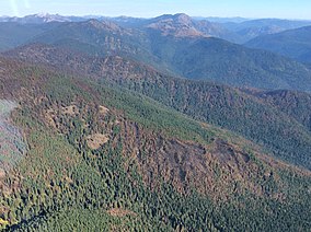
Salmo-Priest Wilderness
| Salmo-Priest Wilderness | |
|---|---|
wilderness area)[1] | |
 | |
| Location | Pend Oreille County, Washington, United States |
| Nearest city | Metaline Falls, Washington |
| Coordinates | 48°55′40″N 117°10′15″W / 48.92778°N 117.17083°W |
| Area | 41,335 acres (167.28 km2) |
| Established | 1984 |
| Governing body | U.S. Forest Service |
Salmo-Priest Wilderness is a 41,335 acre (167.28 km2)
Topography
The high-country Salmo-Priest Wilderness is a somewhat wishbone-shaped area atop two Selkirk Range ridges that intersect at 6,828-foot (2,081 m)
Climate
The Salmo-Priest Wilderness receives 45 to 55 inches of precipitation each year. Winters are long and snowy, with snow not leaving the ground until July in some areas.
Wildlife
This rugged area is home to several endangered and threatened species, including
Vegetation
Vegetation in the Salmo-Priest Wilderness is primarily dominated by
In late-summer both the wildflowers and huckleberries on the ridges are spectacular.
Other protected areas
The
While the officially designated Salmo-Priest Wilderness ends at the Idaho border, the 20,000 acre Salmo/Priest Inventoried Roadless Area borders the wilderness.[9] In Washington, three Inventoried Roadless Areas also border the wilderness, some of which are recommended wilderness in the 2019 Colville National Forest Land Management Plan.[10][11] The area of contiguous Inventoried Roadless Areas and Wilderness is approximately 75,000 acres.
See also
- List of U.S. wilderness areas
- Wilderness Act
- List of old growth forests
References
- ^ "Protected Planet | Salmo-Priest". Protected Planet. Retrieved 2020-10-16.
- ^ a b "Wilderness.net: Salmo-Priest Wilderness". Retrieved 2008-02-14.
- ^ "The Salmo-Priest Wilderness and roadless area". Retrieved 2007-12-23.
- ^ "Mammals of Eastern Washington". Archived from the original on 2007-12-10. Retrieved 2007-12-23.
- ^ "Colville National Forest - Wildlife". Retrieved 2008-02-14.
- ^ .
- ^ "Salmo-Priest Wilderness". Retrieved 2020-11-02.
- ^ "Shedroof Divide". American Trails. 2013-04-24. Retrieved 2014-08-14.
- ^ "Idaho Inventoried Roadless Areas". Retrieved 2020-11-02.
- ^ "Washington State Inventoried Roadless Areas". Retrieved 2020-11-20.
- ^ "2019 Colville National Forest Land Management Plan". Retrieved 2020-11-02.
External links
- Salmo-Priest Wilderness U.S. Forest Service

