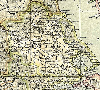
Scotussa
You can help expand this article with text translated from the corresponding article in Greek. (September 2018) Click [show] for important translation instructions.
|
39°23′07″N 22°32′25″E / 39.38533°N 22.5403°E

Scotussa or Skotoussa (
Spartan king Agesilaus II through their country.[5] In 367 BCE, Scotussa was treacherously seized by Alexander of Pherae, tyrant of the neighbouring town of Pherae.[6]
In the territory of Scotussa were the
Antiochus III, but was recovered shortly afterwards, along with Pharsalus and Pherae, by the consul Manius Acilius Glabrio.[10]
Scotussa's site is at Agia Triada in the municipality of Farsala.[11][12]
References
- ^ a b Strabo. Geographica. Vol. vii. p.329. Page numbers refer to those of Isaac Casaubon's edition.
- ^ Periplus of Pseudo-Scylax, p. 64.
- ^ Pausanias (1918). "27.6". Description of Greece. Vol. 7. Translated by W. H. S. Jones; H. A. Ormerod. Cambridge, Massachusetts; London: Harvard University Press; William Heinemann – via Perseus Digital Library.
- ISBN 0-19-814099-1.
- ^ Xenophon. Hellenica. Vol. 4.3.3.
- ^ Diodorus Siculus. Bibliotheca historica (Historical Library). Vol. 15.75.
- ^ Strabo. Geographica. Vol. ix. p.441. Page numbers refer to those of Isaac Casaubon's edition.
- ^ Polybius. The Histories. Vol. 18.3 et seq.
- Ab urbe condita Libri[History of Rome]. Vol. 33.6 et seq.
- Ab urbe condita Libri[History of Rome]. Vol. 36.9-14.
- ^ Lund University. Digital Atlas of the Roman Empire.
- ISBN 978-0-691-03169-9.
