
Siachoque
Siachoque | |
|---|---|
Municipality and town | |
 Central square Siachoque | |
|
UTC-5 (Colombia Standard Time) | |
| Website | Official website |
Siachoque is a town and municipality in the Central Boyacá Province, part of the Colombian department of Boyacá. Siachoque is situated on the Altiplano Cundiboyacense at a distance of 21 kilometres (13 mi) from the department capital Tunja. It borders Toca in the north, Rondón and Viracachá in the south, in the east Toca, Pesca and Rondón and in the west Soracá and Chivatá.[1]
Etymology
The name Siachoque comes from the
Muisca people who inhabited the central highlands of present-day Colombia before the Spanish conquest. It is composed of the words Si; "here", a; "from, taste, smell", chó; "good" and que; "vigorous fortress", translating as "place of good smells and strong and vigorous cultures" or "Land of the vigorous taste".[1][2]
History
Siachoque was part of the loose
zaque of Hunza. At the defeat of the latter the municipality became part of the New Kingdom of Granada and modern Siachoque was founded on August 2, 1556 by friar Jerónimo de Peralta.[1]
Economy
Main economical activities in Siachoque are
Solanum phureja (papa criolla), maize, oat, barley and wheat, livestock farming and processing of meat and dairy products.[1]
Gallery
-
 Central square Siachoque
 -
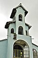 Chapel
 -
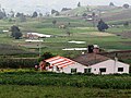 Rural area
 -
 Rural area


References
- ^ a b c d (in Spanish) Official website Siachoque
- ^ (in Spanish) Etymology Siachoque - Excelsio.net
Wikimedia Commons has media related to Siachoque.