
South Padre Island, Texas
South Padre Island, Texas | ||
|---|---|---|
FIPS code 48-69140[3] | | |
| GNIS feature ID | 1376223[4] | |
| Website | myspi | |
South Padre Island is a
The island is only accessible via the Queen Isabella Causeway and has become a popular tourist destination for both the spring, summer and for winter Texans.
Hurricane damage
Storms
- In September 1967, Hurricane Beulah caused extensive damage to much of the town of South Padre Island.[9][10]
- On July 23, 2008, category 1 storm, also causing extensive damage to the town. The Bahia Mar Condominium had extensive damage and had to be gutted due to the damage.
- In September 2008 Hurricane Ike caused moderate damage to the island.
- In July 2010, the island received heavy rains from Hurricane Alex, but the storm left the island generally unscathed.[11]
Industry
Subsequent to rebuilding from
Recreation

The year-round warm tropical weather attracts tourists allowing them to experience the 34 miles of beach, over 300 days of sunshine, and all forms of entertainment from water sports to live music.
Fishing is also popular. Every summer, the Texas International Fishing Tournament is held the first weekend of August,[16][17] with winnings totaling almost a quarter million dollars. Other fishing tournaments include the Ladies Kingfish Tournament,[18] the Ron Hoover Tournament, just to name a few.
In March, the island is a popular spring break destination for college students.[19] The rest of the year it is a popular family resort destination, with July being the most crowded.
In January 2011, the island hosted the
Good views of the nearby
Geography
The town of South Padre Island is located at the southern end of South Padre Island, with the town limits extending from the northern edge of Isla Blanca Park in the south to the end of development north of Wharf Street in the north, a distance of 6 miles (10 km). The Queen Isabella Causeway is the only road access to the mainland; it leads 2.5 miles (4.0 km) across Laguna Madre to the city of Port Isabel. Brownsville is 25 miles (40 km) southwest of South Padre Island.
According to the United States Census Bureau, the town has a total area of 2.3 square miles (6.0 km2), of which 2.1 square miles (5.5 km2) is land and 0.2 square miles (0.5 km2), or 8.44%, is water.[6]
Climate
| South Padre Island | ||||||||||||||||||||||||||||||||||||||||||||||||||||||||||||
|---|---|---|---|---|---|---|---|---|---|---|---|---|---|---|---|---|---|---|---|---|---|---|---|---|---|---|---|---|---|---|---|---|---|---|---|---|---|---|---|---|---|---|---|---|---|---|---|---|---|---|---|---|---|---|---|---|---|---|---|---|
| Climate chart (explanation) | ||||||||||||||||||||||||||||||||||||||||||||||||||||||||||||
| ||||||||||||||||||||||||||||||||||||||||||||||||||||||||||||
| ||||||||||||||||||||||||||||||||||||||||||||||||||||||||||||
South Padre Island experiences a warm
Due to the fact that South Padre Island is surrounded by water, precipitation is a little higher than cities farther inland in the
| Climate data for South Padre Island, Texas | |||||||||||||
|---|---|---|---|---|---|---|---|---|---|---|---|---|---|
| Month | Jan | Feb | Mar | Apr | May | Jun | Jul | Aug | Sep | Oct | Nov | Dec | Year |
| Record high °F (°C) | 83 (28) |
88 (31) |
94 (34) |
94 (34) |
94 (34) |
96 (36) |
96 (36) |
105 (41) |
99 (37) |
94 (34) |
90 (32) |
83 (28) |
105 (41) |
| Mean daily maximum °F (°C) | 67.9 (19.9) |
70.1 (21.2) |
73.9 (23.3) |
78.6 (25.9) |
83.8 (28.8) |
88.0 (31.1) |
88.9 (31.6) |
89.7 (32.1) |
88.6 (31.4) |
84.4 (29.1) |
78.9 (26.1) |
71.4 (21.9) |
80.4 (26.9) |
| Daily mean °F (°C) | 60.9 (16.1) |
63.0 (17.2) |
67.7 (19.8) |
73.3 (22.9) |
78.9 (26.1) |
83.0 (28.3) |
83.3 (28.5) |
84.3 (29.1) |
82.9 (28.3) |
78.5 (25.8) |
72.1 (22.3) |
63.4 (17.4) |
74.3 (23.5) |
| Mean daily minimum °F (°C) | 53.9 (12.2) |
55.9 (13.3) |
61.4 (16.3) |
68.0 (20.0) |
74.0 (23.3) |
78.0 (25.6) |
77.8 (25.4) |
78.9 (26.1) |
77.2 (25.1) |
72.6 (22.6) |
65.3 (18.5) |
55.3 (12.9) |
68.2 (20.1) |
| Record low °F (°C) | 31 (−1) |
25 (−4) |
39 (4) |
45 (7) |
57 (14) |
69 (21) |
63 (17) |
68 (20) |
57 (14) |
40 (4) |
40 (4) |
36 (2) |
25 (−4) |
| Average precipitation inches (mm) | 1.2 (30) |
1.5 (38) |
1.2 (30) |
1.7 (43) |
2.7 (69) |
2.7 (69) |
2.3 (58) |
2.3 (58) |
4.4 (110) |
3.1 (79) |
1.5 (38) |
1.4 (36) |
26 (658) |
| Source: [22] | |||||||||||||
Demographics
| Census | Pop. | Note | %± |
|---|---|---|---|
| 1980 | 791 | — | |
| 1990 | 1,677 | 112.0% | |
| 2000 | 2,422 | 44.4% | |
| 2010 | 2,816 | 16.3% | |
| 2019 (est.) | 2,778 | [2] | −1.3% |
| U.S. Decennial Census | |||
2020 census
| Race | Number | Percentage |
|---|---|---|
White (NH)
|
1,322 | 63.99% |
Black or African American (NH)
|
15 | 0.73% |
Alaska Native (NH)
|
7 | 0.34% |
| Asian (NH) | 64 | 3.1% |
| Some Other Race (NH) | 5 | 0.24% |
| Mixed/Multi-Racial (NH) | 44 | 2.13% |
| Hispanic or Latino | 609 | 29.48% |
| Total | 2,066 |
As of the 2020 United States census, there were 2,066 people, 1,477 households, and 892 families residing in the town.
2000 census
As of the
There were 1,211 households, out of which 15.4% had children under the age of 18 living with them, 47.2% were married couples living together, 4.2% had a female householder with no husband present, and 45.3% were non-families. 35.8% of all households were made up of individuals, and 7.8% had someone living alone who was 65 years of age or older. The average household size was 2.00 and the average family size was 2.54.
In the town, the population was spread out, with 12.9% under the age of 18, 6.2% from 18 to 24, 28.2% from 25 to 44, 34.2% from 45 to 64, and 18.4% who were 65 years of age or older. The median age was 47 years. For every 100 females, there were 113.8 males. For every 100 females age 18 and over, there were 115.9 males.
The
Education
Children living in South Padre Island are zoned to schools in Point Isabel Independent School District. Children go to Garriga Elementary School (prek-5th), Port Isabel Junior High School (6–8), and Port Isabel High School (9–12). All of the schools are in Port Isabel.[26]
In addition, South Padre Island residents may apply to schools in the South Texas Independent School District.[27]
All of Cameron County is in the service area of Texas Southmost College.[28]
Government
The United States Postal Service operates the South Padre Island Post Office.[29]
Coast Guard Station South Padre Island is a United States Coast Guard search and rescue station on South Padre Island.[30]
Transportation
Brownsville/South Padre Island International Airport in Brownsville and Valley International Airport in Harlingen serve the island.[31]
A new, second causeway to South Padre Island has been designated as Texas State Highway 104, it will be situated 3 to 4 miles north of the existing Queen Isabella Causeway, just north of the South Padre Island Convention Center and approximately 3 to 4 miles north of State Highway 100. [32]
In popular culture
South Padre Island is the main setting of Season 4 Episode 20 "Conflicted" of Criminal Minds.[33]
Gallery
-
 A street in SPI with residences and condominiums
 -
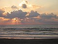 A person taking an early morning walk on the Gulf side of the island
 -
 This walkway provides access to the beach from a condo.
 -
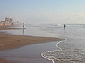 A beach in South Padre Island
 -
 One of the smaller venues for the South Padre International Music Festival


See also
- Queen Isabella Causeway
- Boca Chica (Texas)
- Brazos Santiago Pass (Texas)
- SpaceX Starbase
- Lower Rio Grande Valley
- Gulf of Mexico
References
- ^ "2019 U.S. Gazetteer Files". United States Census Bureau. Archived from the original on October 17, 2020. Retrieved August 7, 2020.
- ^ a b "Population and Housing Unit Estimates". United States Census Bureau. May 24, 2020. Archived from the original on April 21, 2019. Retrieved May 27, 2020.
- ^ a b "U.S. Census website". United States Census Bureau. Archived from the original on July 1, 2021. Retrieved January 31, 2008.
- ^ "US Board on Geographic Names". United States Geological Survey. October 25, 2007. Archived from the original on January 7, 2019. Retrieved January 31, 2008.
- ^ Handbook of Texas Online article for South Padre Island Archived February 4, 2019, at the Wayback Machine Accessed May 17, 2007.
- ^ a b "Geographic Identifiers: 2010 Census Summary File 1 (G001): South Padre Island town, Texas". U.S. Census Bureau, American Factfinder. Archived from the original on February 13, 2020. Retrieved July 8, 2015.
- ^ Handbook of Texas Online biography of José Nicolás Ballí Archived July 25, 2020, at the Wayback Machine Accessed May 16, 2007.
- ^ Winter Texans
- ^ Handbook of Texas Online article on hurricanes in Texas Archived August 11, 2018, at the Wayback Machine Accessed May 16, 2007.
- ^ Padre Island's history with tropical systems Archived February 18, 2007, at the Wayback Machine Accessed May 17, 2007.
- ^ http://www.themonitor.com/articles/south-40402-island-party.html/ South Padre Island largely unscathed by Hurricane Alex
- ^ Background information on Schlitterbahn developments in Texas Archived 2007-07-05 at the Wayback Machine Accessed May 16, 2007.
- ^ "City of SPI".
- ^ Cervera, Sara. "Crews on standby to rescue cold stunned sea turtles at South Padre Island". KRGV. Retrieved April 7, 2024.
- ^ "Birding Center celebrates Monarch migration with Sixth Annual Hallo-Wings". Retrieved April 7, 2024.
- ^ "About TIFT". Texas International Fishing Tournament. Archived from the original on March 30, 2023. Retrieved March 30, 2023.
- ^ "Meet Felicia Calo: Hostess for the 81st TIFT". Port Isabel-South Padre Press. July 1, 2020. Archived from the original on March 30, 2023.
- ^ "Ladies Kingfish Tournament Returns". Valley Business Journal. July 27, 2021. Archived from the original on March 30, 2023.
- TIME. p. 87. Archivedfrom the original on March 30, 2023. Retrieved March 30, 2023.
- ^ "NBD-D Leauge".
- ^ "Fiery crash of SpaceX's Starship rocket ignites dreams of future spaceflight". National Geographic. Archived from the original on December 10, 2020. Retrieved December 12, 2020.
- ^ "Monthly Averages for South Padre Island, TX". weatherbase.com. Archived from the original on December 25, 2017. Retrieved December 24, 2017.
- ^ "Explore Census Data". data.census.gov. Archived from the original on May 21, 2022. Retrieved May 21, 2022.
- ^ https://www.census.gov/ Archived July 1, 2021, at the Wayback Machine [not specific enough to verify]
- ^ "About the Hispanic Population and its Origin". www.census.gov. Archived from the original on May 20, 2022. Retrieved May 18, 2022.
- ^ Port Isabel ISD Archived June 25, 2007, at the Wayback Machine Accessed May 16, 2007.
- ^ South Texas Independent School District Archived 2007-08-29 at archive.today Accessed May 16, 2007.
- ^ Texas Education Code, Sec. 130.204. TEXAS SOUTHMOST COLLEGE DISTRICT SERVICE AREA. Archived September 22, 2021, at the Wayback Machine.
- ^ "Post Office Location – South Padre Island Archived December 29, 2016, at the Wayback Machine." United States Postal Service. Retrieved on December 28, 2016.
- ^ U.S. Coast Guard Eighth District Units Archived December 29, 2016, at the Wayback Machine. Retrieved on December 28, 2016.
- ^ "Southwest Airlines Cities Archived September 19, 2010, at the Wayback Machine," Southwest Airlines
- ^ Pedraza, Ray. "Media Contact". Texas Department of Transportation. TxDOT.
- ^ Criminal Minds IMDB Archived March 15, 2016, at the Wayback Machine," Criminal Minds "Conflicted" (2009)
External links
 Media from Commons
 Travel information from Wikivoyage
Municipalities and communities of Cameron County, Texas, United States | ||
|---|---|---|
| Cities |  | |
| Towns | ||
Village | ||
| CDPs |
| |
| Other communities | ||
| Ghost towns | ||
| ||
| International | |
|---|---|
| National | |