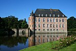
Spanjaardenkasteel
You can help expand this article with text translated from the corresponding article in Dutch. (June 2021) Click [show] for important translation instructions.
|

The Spanjaardenkasteel ("Spaniards' Castle") was a castle in the city of Ghent in present-day Belgium.
The castle was commissioned in 1540 by the
rebellion by the city.[1] The castle housed a garrison of about 2,500 men. The castle was eventually demolished in the 19th century.[citation needed
]
References
- ^ "Castrum Novum Gandavense". STAM (in Dutch). Retrieved 5 February 2024.
External links
Wikimedia Commons has media related to Spanjaardenkasteel.


