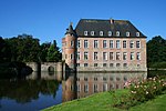
Trazegnies Castle
Trazegnies Castle (
Hainaut
.
History
Trazegnies was originally a powerful independent seigneurie on the edges of the Duchy of Brabant, the County of Hainaut and the Prince-Bishopric of Liège and was ruled by a separate dynasty. The original castle was built by Gilles I in the 11th century but was almost completely destroyed in 1554 by the armies of Henry II of France during the Italian War of 1551–1559. Subsequently rebuilt, a corps de logis was added to the castle by Gillion-Othon de Trazegnies in the Louis XIII style in the 17th century.
The extinction of the Trazegnies dynasty led to the sale of the castle to a
coal mine which partitioned off its land, leaving the castle itself to the Belgian state. It had become derelict by 1926 and suffered severe damage from subsidence as a result of underground mining. However, a civic association called the "Friends of Trazegnies Castle" (Les Amis du Château de Trazegnies) successfully opposed its destruction and began a gradual programme of restoration with the support of the Walloon Region
. The castle is currently open to the public on designated days.
-
Depiction of the castle in Brabantia Illustrata (1705) looking northwards
-
View of the gatehouse on the north side
-
Modern view of the 17th-century corps de logis and south-east tower
-
Coat of arms of the Trazegnies family
See also
- List of castles in Belgium
- Marquess of Trazegnies d'Ittre
External links
 Media related to Trazegnies Castle at Wikimedia Commons
- Trazegnies Castle website
50°27′41″N 4°19′48″E / 50.4614°N 4.330°E


