
Sterling, Georgia
Sterling, Georgia | |
|---|---|
UTC-4 (EDT) | |
| ZIP Code | 31525 |
| Area code | 912 |
| FIPS code | 13-73452 |
Sterling is an
unincorporated community and census-designated place (CDP) in Glynn County, Georgia, United States, located on U.S. Route 341. Sterling consists of several small churches and general stores. It is included in the Brunswick, Georgia
statistical area.
The 2020 census listed a population of 2,534.[2]
Sterling formerly had a station on the Macon and Brunswick Railroad.[3]
Demographics
| Census | Pop. | Note | %± |
|---|---|---|---|
| 2020 | 2,534 | — | |
| U.S. Decennial Census[4] 2020[5] | |||
Sterling was first listed as a
2020 U.S. Census.[5]
| Race / Ethnicity | Pop 2020[5] | % 2020 |
|---|---|---|
White alone (NH)
|
1,402 | 55.33% |
Black or African American alone (NH)
|
485 | 19.14% |
Alaska Native alone (NH)
|
15 | 0.59% |
| Asian alone (NH) | 54 | 2.13% |
| Pacific Islander alone (NH) | 3 | 0.12% |
| Some Other Race alone (NH) | 11 | 0.43% |
| Mixed Race or Multi-Racial (NH) | 119 | 4.70% |
| Hispanic or Latino (any race) | 445 | 17.56% |
| Total | 2,534 | 100.00% |
Education

Glynn County's public schools are operated by Glynn County School System.[6][7]
Zoned schools include:
- Sterling Elementary School (SES)[8]
- Jane Macon Middle School (JMS)[9]
- Brunswick High School (BHS)[10]
References
Wikimedia Commons has media related to Sterling, Georgia.
- ^ "2020 U.S. Gazetteer Files". United States Census Bureau. Retrieved December 18, 2021.
- ^ "Sterling CDP, Georgia". United States Census Bureau. Retrieved April 7, 2022.
- ISBN 9780820343105.
- US Census Bureau.
- ^ a b c "P2 HISPANIC OR LATINO, AND NOT HISPANIC OR LATINO BY RACE – 2020: DEC Redistricting Data (PL 94-171) – Sterling CDP, Georgia". United States Census Bureau.
- U.S. Census Bureau. Retrieved 2023-02-25. - Shows Sterling in this school district.
- U.S. Census Bureau. Retrieved 2023-02-25. - Compare to the school district boundary maps.
- ^ "Elementary School Zones Map." Glynn County School System. Retrieved on March 13, 2019.
- ^ "Middle School Zones Map." Glynn County School System. Retrieved on March 13, 2019. Detail of Jane Macon MS Zone Map
- ^ "High School Zones Map." Glynn County School System. Retrieved on March 13, 2019.
Municipalities and communities of Glynn County, Georgia, United States | ||
|---|---|---|
| City | 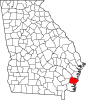 | |
| CDPs |
| |
| Other unincorporated communities | ||
| Ghost towns | ||
| ||