
Dock Junction, Georgia
Dock Junction, Georgia | ||
|---|---|---|
FIPS code 13-23200[2] | | |
| GNIS feature ID | 1867239[3] | |
Dock Junction is an
metropolitan statistical area. The population was 7,721 at the 2010 census, growing to 8,266 in 2020.[4] Its original name was Arco until the 1970s, the name deriving from the Atlantic Refining Company.[5]
Geography
Dock Junction is located at 31°12′4″N 81°30′25″W / 31.20111°N 81.50694°W (31.201106, -81.506921).[6]
According to the United States Census Bureau, the CDP has a total area of 10.7 square miles (28 km2), of which 9.6 square miles (25 km2) is land and 1.1 square miles (2.8 km2) (10.66%) is water.
Demographics
| Census | Pop. | Note | %± |
|---|---|---|---|
| 1950 | 4,160 | — | |
| 1960 | 5,417 | 30.2% | |
| 1970 | 6,009 | 10.9% | |
| 1980 | 6,189 | 3.0% | |
| 1990 | 7,094 | 14.6% | |
| 2000 | 6,951 | −2.0% | |
| 2010 | 7,721 | 11.1% | |
| 2020 | 8,266 | 7.1% | |
| U.S. Decennial Census[7] 1850-1870[8] 1870-1880[9] 1890-1910[10] 1920-1930[11] 1940[12] 1950[13] 1960[14] 1970[15] 1980[16] 1990[17] 2000[18] 2010[19] 2020[4] | |||
Dock Junction was first listed as an unincorporated place in 1950census designated place in 1980.[16]
| Race / Ethnicity | Pop 2000[20] | Pop 2010[19] | Pop 2020[4] | % 2000 | % 2010 | % 2020 |
|---|---|---|---|---|---|---|
White alone (NH)
|
4,634 | 4,461 | 4,168 | 66.67% | 57.78% | 50.42% |
Black or African American alone (NH)
|
2,005 | 2,127 | 2,533 | 28.84% | 27.55% | 30.64% |
Alaska Native alone (NH)
|
12 | 14 | 12 | 0.17% | 0.18% | 0.15% |
| Asian alone (NH) | 26 | 115 | 125 | 0.37% | 1.49% | 1.51% |
| Pacific Islander alone (NH) | 9 | 0 | 8 | 0.13% | 0.00% | 0.10% |
| Some Other Race alone (NH) | 4 | 7 | 48 | 0.06% | 0.09% | 0.58% |
| Mixed race or Multiracial (NH) | 50 | 130 | 336 | 0.72% | 1.68% | 4.06% |
| Hispanic or Latino (any race) | 211 | 867 | 1,036 | 3.04% | 11.23% | 12.53% |
| Total | 6,951 | 7,721 | 8,266 | 100.00% | 100.00% | 100.00% |
As of the 2020 United States census, there were 8,266 people, 2,976 households, and 1,942 families residing in the CDP.
Education
The community's public schools are operated by Glynn County School System.
Zoned schools serving sections of the CDP include:[21]
- Glyndale Elementary School (GES), Golden Isles Elementary School (GIE), Goodyear Elementary School (GOE), and Sterling Elementary School (SES)[22]
- Glynn Middle School (GMS), Jane Macon Middle School (JMS), Needwood Middle School (NMS), and Risley Middle School (RMS)[23]
- Brunswick High School (BHS) and Glynn Academy (GA)[24]
References
- ^ "2020 U.S. Gazetteer Files". United States Census Bureau. Retrieved December 18, 2021.
- ^ "U.S. Census website". United States Census Bureau. Retrieved January 31, 2008.
- ^ "US Board on Geographic Names". United States Geological Survey. October 25, 2007. Retrieved January 31, 2008.
- ^ a b c "P2: Hispanic or Latino, and Not Hispanic or Latino by Race – 2020: DEC Redistricting Data (PL 94-171) – Dock Junction CDP, Georgia". United States Census Bureau.
- ^ Temple, Robert D. Edge Effects: The Border-Name Places, (2nd edition, 2009), iUniverse, page 323.
- ^ "US Gazetteer files: 2010, 2000, and 1990". United States Census Bureau. February 12, 2011. Retrieved April 23, 2011.
- US Census Bureau.
- US Census Bureau. 1870.
- US Census Bureau. 1880.
- US Census Bureau. 1930.
- US Census Bureau. 1930. p. 251-256.
- US Census Bureau. 1940.
- ^ US Census Bureau. 1980.
- US Census Bureau. 1960.
- US Census Bureau. 1970.
- ^ US Census Bureau. 1980.
- US Census Bureau. 1990.
- US Census Bureau. 2000.
- ^ a b "P2: Hispanic or Latino, and Not Hispanic or Latino by Race – 2010: DEC Redistricting Data (PL 94-171) – Dock Junction CDP, Georgia". United States Census Bureau.
- ^ "P004 Hispanic or Latino, and Not Hispanic or Latino by Race – 2000: DEC Summary File 1 – Dock Junction CDP, Georgia". United States Census Bureau.
- .
- ^ "Elementary School Zones Map Archived 2019-03-12 at the Wayback Machine." Glynn County School System. Retrieved on March 13, 2019.
- ^ "Middle School Zones Map Archived 2019-03-12 at the Wayback Machine." Glynn County School System. Retrieved on March 13, 2019. Detail maps: GMS Archived 2019-03-12 at the Wayback Machine, JMS[permanent dead link], NMS Archived March 12, 2019, at the Wayback Machine, and RMS Archived March 12, 2019, at the Wayback Machine.
- ^ "High School Zones Map Archived 2019-03-12 at the Wayback Machine." Glynn County School System. Retrieved on March 13, 2019.
Municipalities and communities of Glynn County, Georgia, United States | ||
|---|---|---|
| City | 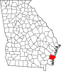 | |
| CDPs |
| |
| Other unincorporated communities | ||
| Ghost towns | ||
| ||