
St. Simons, Georgia
St. Simons Island, Georgia | ||
|---|---|---|
FIPS code 13-68040[2] | | |
| GNIS feature ID | 0322308[3] | |
St. Simons Island (or simply St. Simons) is a
In addition to its base of permanent residents, the island enjoys an influx of visitors and part-time residents throughout the year. The 2010 census noted that 26.8% of total housing units were for "seasonal, recreational, or occasional use".
Originally inhabited by the
History
Pre-European contact


Just north of the village on St. Simons Island off Mallery Street is a park of oak trees named St. Simons Park. On the southern edge of the oaks, along a narrow lane, is a low earthen mound where 30 Timucuan Native Americans are buried. The men, women, and children interred there lived in a settlement on the site two centuries before the first European contact.[citation needed]
Cannon's Point, on the north end of St. Simon's Island, is an archaeological site that includes a
Many scholars in the early 20th century identified the people of St. Simons Island as Guale. Hann cites evidence that the people of St. Simons, at least as early as 1580, were part of the Mocama people.[15] Ashley et al. suggest that St. Simons may have been occupied by the Guale people when Europeans arrived in southeastern Georgia in the 16th century and that the original Guale population on St. Simons was displaced from at least the southern part of the island after the Guale rebellion of 1597, and replaced by Timucua speaking Mocama people.[16]
The mission of San Buenaventura de Guadalquini was established on the southern end of St. Simons sometime between 1597 and 1609 (probably near the present-day St. Simons Island Light) and was the northernmost mission in the Mocama area. The Timucua language name for St. Simon's Island was Guadalquini. The Spanish called it Isla de Ballenas (Isle of Whales). Some Spanish documents called the island Boadalquivi.[17][18][19]
Raiders from the Chichimecos (the Spanish name for
In 1683, St. Augustine was attacked by a pirate fleet, and in 1684 missions along what is now the Georgia coast were attacked by Native American allies of the English. The mission of San Buenaventura was ordered to move south and merge with the mission of San Juan del Puerto on the St. Johns River. Before the mission could be moved, pirates returned to the area in the second half of 1684. On hearing of the presence of the pirates, Lorenzo de Santiago, chief of San Buenaventura, moved the people of his village, along with most of their property and stored maize, to the mainland. When the pirates landed at San Buenaventura, they found only ten men under a sub-chief who had been left to guard the village. The San Buenaventura men withdrew to the woods, and the pirates burned the village and mission.[24][25] After the pirates burned the mission, the people of Guadalquini moved to a site about one league west of San Juan del Puerto on the St. Johns River, where a new mission named Santa Cruz de Guadalquini was established.[26]
Fort Frederica

Fort Frederica, now
.Nearby is the site of the Battle of Gully Hole Creek and Battle of Bloody Marsh, where on July 7, 1742, the British ambushed Spanish troops marching single file through the marsh and routed them from the island. This marked the end of the Spanish efforts to invade Georgia during the War of Jenkins' Ear.[27]
It was preserved in the 20th century and identified as a national historic site largely by the efforts of Margaret Davis Cates, a resident who contributed much to historic preservation. She helped raise more than $100,000 (~$1.6 million in 2023) in 1941 to buy the site of the fort and conduct stabilization and some preservation. It was designated as a
Wesley brothers

In the 1730s, St. Simons served as a sometime home to John Wesley, the young minister of the colony at Savannah. He later returned to England, where in 1738, he founded the evangelical movement of Methodism within the Anglican Church. Wesley performed missionary work at St. Simons but was despondent about failing to bring about conversions. (He wrote that the local inhabitants had more tortures from their environment than he could describe for Hell). In the 1730s, John Wesley's brother Charles Wesley also did missionary work on St. Simons.[29] In the late eighteenth century, Methodist preachers traveled throughout Georgia as part of the Great Awakening, a religious revival movement led by Methodists and Baptists. A significant impact of the revival was to convert enslaved African-Americans in Georgia (as well as those in the rest of the Thirteen Colonies) to Christianity.
On April 5, 1987, fifty-five St. Simons United Methodist Church members were commissioned, with Bishop Frank Robertson as the first pastor, to begin a new church on the north end of St. Simons Island. This was where John and Charles Wesley had preached and ministered to the people at
American Revolution
In 1778 Colonel Samuel Elbert commanded Georgia's Continental Army and Navy. On April 15, he learned that four British vessels (the naval vessels HMS Galatea and HMS Hinchinbrook, and the hired vessels Rebecca, and Hatter) from East Florida were sailing in St. Simons Sound. Elbert commanded about 360 troops from the Georgia Continental Battalions at Fort Howe to march to Darien, Georgia. There they boarded three Georgia Navy galleys: Washington, commanded by Captain John Hardy; Lee, commanded by Captain John Cutler Braddock; and Bulloch, commanded by Captain Archibald Hatcher.
On April 18, they entered Frederica River and anchored about 1.5 miles (2.4 km) from
Cotton production

During the
American Civil War and its aftermath
During the early stages of the war, Confederate troops occupied St. Simons Island to protect its strategic location at the entrance to Brunswick harbor. However, in 1862,
Postwar, the island plantations were in ruins, and landowners found it financially unfeasible to cultivate cotton or rice. Most moved inland to pursue other occupations, and the island's economy remained dormant for several years. Formerly enslaved people established a community in the center of the island known as Harrington.[32]
Since Reconstruction
Saint Simons' first exports of
The second phase of lumber production on the island began in the late 1870s when mills were constructed in the area surrounding Gascoigne Bluff. The mills supported a vibrant community that lasted until just after the turn of the twentieth century. During this time, lumber from St. Simons was shipped to New York City for use in the construction of the Brooklyn Bridge.[34]
In contrast to the post-Civil War era, the decline of lumber did not open a new period of economic hardship; for a new industry was taking hold on St. Simons Island. As early as the 1870s, summer cottages were being constructed on the island's south end, and a small village was forming to serve them. Construction of the pier in 1887 brought visitors by boat from Brunswick and south Georgia.[35] The Hotel St. Simons, on the present site of Massengale Park, opened in 1888.[36] About a decade later, two hotels were built near the pier. The arrival of the automobile and the opening of the Torras Causeway in 1924 ensured the continued growth of tourism on St. Simons, the only one of the Golden Isles not privately held. New hotels were built. Roads were constructed, and tourism became the dominant force in the Island's economy.[37]

On April 8, 1942,
President Jimmy Carter visited the island with his brother Billy Carter in 1977, arriving by Marine One.[41]
During the postwar years, as resort and vacation travel increased, permanent residential development began to take place on St. Simons Island and surrounding mainland communities. The island's population grew from 1,706 in 1950 to 13,381 by 2000.[42][43]
Geography
| St. Simons Island | ||||||||||||||||||||||||||||||||||||||||||||||||||||||||||||
|---|---|---|---|---|---|---|---|---|---|---|---|---|---|---|---|---|---|---|---|---|---|---|---|---|---|---|---|---|---|---|---|---|---|---|---|---|---|---|---|---|---|---|---|---|---|---|---|---|---|---|---|---|---|---|---|---|---|---|---|---|
| Climate chart (explanation) | ||||||||||||||||||||||||||||||||||||||||||||||||||||||||||||
| ||||||||||||||||||||||||||||||||||||||||||||||||||||||||||||
| ||||||||||||||||||||||||||||||||||||||||||||||||||||||||||||
St. Simons Island is part of a cluster of
St. Simons is located at 31°9′40″N 81°23′13″W / 31.16111°N 81.38694°W (31.161250, -81.386875),[44] midway between Savannah, Georgia and Jacksonville, Florida, and approximately 12 miles (19 km) east of Brunswick, Georgia, the sole municipality in Glynn County and the county government seat.
Climate
The Köppen Climate Classification System rates the climate of St. Simons Island as humid subtropical.[45] Ocean breezes tend to moderate the island climate, as compared to the nearby mainland.[46] Daytime mean highs in winter range from 61 to 68 °F (16 to 20 °C), with nighttime lows averaging 43 to 52 °F (6 to 11 °C). Summertime mean highs are 88 to 90 °F (31 to 32 °C), with average lows 73 to 75 °F (23 to 24 °C). The average rainfall is 45 inches per year. Rainfall is greatest in August and September when passing afternoon thunderstorms are typical. Accumulation of snow/ice is extremely rare. The last recorded snow on St. Simons was in 1989.[47] The island is located in USDA Plant Hardiness Zone 9a.[48]
According to the United States Census Bureau, the CDP has a total area of 17.7 square miles (46 km2), 15.9 square miles (41 km2) of which is land and 1.7 square miles (4.4 km2) of it (10 percent) is water.
Ecology, vegetation, and wildlife
A diverse and complex ecology exists alongside residential and commercial development on St. Simons Island. The island shares many features common to the chain of sea islands along the southeastern U.S. coast, such as sandy beaches on the ocean side, marshes to the west, and maritime forests inland. Despite centuries of agriculture and development, a canopy of live oaks and other hardwoods draped in Spanish moss continues to shade much of the island. The abundance of food provided by the marshes, estuaries, and vegetation attracts various wildlife on the land, sea, and in the air.[49]
Commonly sighted land and
The area surrounding St. Simons Island and the Altamaha River delta is an important stopover for migrating shorebirds traveling between
The waters off St. Simons Island are likewise home to a great variety of sea life, including dolphins, right whales, a wide diversity of gamefish, and the occasional manatee. On late spring and summer nights, loggerhead sea turtles arrive on the beach to lay their eggs. Area naturalists monitor and protect nests, and guided turtle walks are available. Shrimping is still important to the region, and shrimp boats are often seen just off the beaches.
Like most barrier islands, St. Simons Island beaches constantly shift as tides, wind, and storms move tons of sand annually. Along with umbrellas and folding chairs, beach-goers can encounter fast-moving
Cannon's Point Preserve
In September 2012, following an 18-month fund-raising effort, the St. Simons Land Trust acquired a 608-acre tract of undeveloped land in the northeast portion of the island. The acreage includes maritime forest, salt marsh, tidal creek, and river shoreline, as well as ancient shell middens and remains of the John Couper plantation of the early 19th century.
The Preserve is open to the public on Saturdays, Sundays, and Mondays, 9 AM-3 PM, for hiking, bicycling, bird-watching, and picnicking. The Preserve also features a launch site for kayaks, canoes, and paddleboards and an observation tower at the north end.[52]
Demographics
| Census | Pop. | Note | %± |
|---|---|---|---|
| 1950 | 1,706 | — | |
| 1960 | 3,199 | 87.5% | |
| 1970 | 5,346 | 67.1% | |
| 1980 | 6,566 | 22.8% | |
| 1990 | 12,026 | 83.2% | |
| 2000 | 13,381 | 11.3% | |
| 2010 | 12,743 | −4.8% | |
| 2020 | 14,982 | 17.6% | |
| U.S. Decennial Census[53] 1850-1870[54] 1870-1880[55] 1890-1910[56] 1920-1930[57] 1940[58] 1950[59] 1960[60] 1970[61] 1980[62] 1990[63] 2000[64] 2010[65] 2020[66] | |||
St. Simons was first listed as an unincorporated place in the
| Race / Ethnicity | Pop 2000[67] | Pop 2010[65] | Pop 2020[66] | % 2000 | % 2010 | % 2020 |
|---|---|---|---|---|---|---|
White alone (NH)
|
14,426 | 11,889 | 13,709 | 92.86% | 93.30% | 91.50% |
Black or African American alone (NH)
|
486 | 338 | 288 | 3.63% | 2.66% | 1.92% |
Alaska Native alone (NH)
|
16 | 17 | 19 | 0.12% | 0.13% | 0.13% |
| Asian alone (NH) | 123 | 117 | 112 | 0.92% | 0.92% | 0.75% |
| Pacific Islander alone (NH) | 2 | 2 | 4 | 0.01% | 0.02% | 0.03% |
| Some Other Race alone (NH) | 3 | 18 | 54 | 0.02% | 0.14% | 0.36% |
| Mixed race or Multiracial (NH) | 72 | 77 | 346 | 0.54% | 0.60% | 2.31% |
| Hispanic or Latino (any race) | 253 | 284 | 450 | 1.89% | 2.23% | 3.00% |
| Total | 13,381 | 12,743 | 14,982 | 100.00% | 100.00% | 100.00% |
According to the census of 2010,[68] there were 12,743 people, 6,117 households, and 3,637 families residing in the CDP, occupying a land area of 15.94 square miles (41.3 square kilometres). The population density was 799.4 inhabitants per square mile (308.7/km2). There were 9,931 housing units at an average density of 623.0 per square mile (240.5/km2). The racial makeup of the CDP was 94.8 percent White, 2.8 percent African American, 0.1 percent Native American, 1.0 percent Asian, 1.53 percent from other races, and 0.7 percent from two or more races. Hispanic or Latino of any race were 2.2 percent of the population. By the 2020 census,[8] there were 14,982 people, 6,836 households, and 4,346 families in the CDP. The racial and ethnic makeup of the CDP by 2020 was 91.5% non-Hispanic white, 1.92% Black or African American, 0.13% Native American, 0.75% Asian, 0.03% Pacific Islander, 2.67% multiracial, and 3.0% Hispanic or Latino of any race.
In 2010, the median income for a household in the CDP was $77,694, and the median income for a family was $104,044. Males had a median income of $52,536 versus $39,881 for females. The per capita income for the CDP was $50,043. About 1.9 percent of families and 3.7 percent of the population were below the poverty line, including 1.4 percent of those under age 18 and 2.9 percent of those age 65 or over. In the 2020 American Community Survey, the median household income increased to $90,408 with a mean of $120,362.[69] Families had a median household income of $117,466; married-couple families $125,652; and non-family households $52,607.
The primary housing units on St. Simons Island are single-family homes and condominiums. Prices vary with market trends, but housing is generally available in a wide range of prices, depending on location. In 2010, according to the U.S. Census Bureau, there were 9,931 housing units on the island, 6,117 of which were occupied either by the owners (74%) or renters (26%); and 2,662 were held for "seasonal, recreational, or occasional use." Most of the remainder were for rent (6%) or for sale (4%).[70] In 2020, the median value of owner-occupied housing units was $386,000 with a monthly cost of $2,010.[71]
Government and infrastructure

The
Economy
.jpg)
Tourism is the primary economic driver in the St. Simons Island economy. Major industries include hospitality, food services, retail, service businesses, and the professions.[73] The largest employers are the Sea Island Company, King & Prince Resort and Rich Products Consumer Brands Division.[74]

Visitors have been coming to St. Simons Island since the late 19th century, first by boat, disembarking at the pier on its south shore, and later by car via the
Today, the island is marketed as one of Georgia's "Golden Isles", and visitation occurs throughout the year but is heaviest in the spring and summer months. Accommodations consist primarily of hotels, private rental homes, and condominium apartments along the beach and inland. Transportation is provided via taxis and vehicle rentals, including golf carts. Bicycle rentals are also available.
Visitors come to St. Simons Island for its beaches, scenic vistas, water sports, fishing, sailing, golf, historical sites, and laid-back lifestyle. The PGA Tour's RSM Classic (formerly McGladrey Classic) is held annually in November at the Sea Island Golf Club on St. Simons Island. In 2013 The Sea Island Golf Club was ranked by Golf Digest as one of America's top 50 golf courses for women.
Ecotourists come to enjoy the natural surroundings, bird-watching, and Cannon's Point Preserve. Hiking and bicycling are popular year-round activities. St. Simons Island is also a magnet for photographers and painters. Its selection of scenic and historic venues, such as the St. Simons Lighthouse and Christ Church, have made the island a popular wedding site.
As a travel destination, St. Simons Island has received recommendations from several travel publications and websites, including
Arts and culture
Many creative artists are drawn to St. Simons Island as residents and visitors. Painters and photographers work to capture the scenic landscape, and their work is on display in several island galleries. Glynn Visual Arts is a non-profit organization serving local artists with exhibits, festivals, and classes in several media, including
There is a vibrant music scene on St. Simons Island, with local bands and musicians appearing in several venues, including summertime concerts on the oceanfront lawn by the lighthouse and classical music concerts sponsored by the Island Concert Association.[78]
Novelist Eugenia Price visited St. Simons Island while driving from Chicago to Jacksonville in 1961. Fascinated by the island, she spent the next few years researching, eventually resulting in three novels known as the "St. Simons Trilogy." She lived on St. Simons from 1965 until she died in 1996.[79]
The film
Black American heritage
After the American Civil War, many Geechee people who had been enslaved remained on St. Simons Island, subsisting on whatever they could harvest from their gardens and the surrounding waters. Many later found jobs with the lumber mills starting in the 1870s.[34] They attended the First African Baptist Church, completed in 1869 by formerly enslaved people from St. Simons Island plantations. Regular services are still held today at the original site on Frederica Road, which has been diligently cared for and renovated through the years.[81][82]
In October 2000, at the First African Baptist Church, a group of island residents and property owners formed the St. Simons African American Heritage Coalition to protect and preserve the history and heritage of African-Americans on St. Simons Island. Today, the coalition conducts tours of historic sites and produces the annual Georgia Sea Islands Festival to celebrate traditional Geechee African-American music, food, and crafts. More recently, the coalition, together with Friends of Harrington School, has organized a successful fund-raising effort to restore the historic Harrington School House, which was initially built in the 1920s to serve the island's Geechee or African-American children.[83]
Sports and activities
The climate on St. Simons Island is conducive to various outdoor sports and activities year-round. Golfing is one of the most popular, with seven golf courses on the island.[84] Public tennis courts are located at Epworth Park and Mallery Park, each with lines marked for pickleball, a fast-growing paddle sport. Several island resorts also offer tennis facilities.
Eight public parks are on the island, with picnic tables, sports fields, and playgrounds. Demere Park features a skate park, and Gascoigne Park offers a disc golf course and a waterfront picnic area. The Neptune Park Fun Zone, on the south end of the island, near the Pier Village, includes a public swimming pool, miniature golf, two playgrounds, picnic tables, and restrooms.[85][86] The adjacent St. Simons Casino Building hosts weddings, parties, meetings, and is home to the St. Simons Library.
Beach access points are along the island's Atlantic shoreline, but the most popular are Coast Guard Beach and Massengale Park. Both have restrooms and ADA-accessible beach access. Massengale Park also includes picnic tables and a playground.[87]
Hikers, walkers, and bikers can enjoy the St. Simons Island-wide Trail System that stretches from the Village area to East Beach and Hampton Point at the north end.[88] Other options include the Alice Richards Botanical Trail in Frederica Park, the John Gilbert Nature Trail just off Frederica Road, the Southeast Georgia Health System Fitness Trail near Gascoigne Bluff, and Cannon's Point Preserve (appropriate clothing and provisions for a wilderness area are recommended). Additional outdoor activities include kayaking, paddleboarding, and horseback riding. Boating and sailing excursions are also available.
Neptune Park
Neptune Park includes the Neptune Park Fun Zone and is in the "village" area and adjacent to the pier. Neptune Park was named after Neptune Small, a man enslaved by Retreat Plantation owner Henry King. King and his brothers fought for the Confederacy in the American Civil War, taking Small. At the Battle of Fredericksburg, King was killed. When night fell and King had not returned from the battlefield, Small went to look for him. Small found King's body and personally brought it back from Virginia to St. Simons for burial (at Christ Church). The King family gave Neptune Small 8 acres of their plantation, part of which is now Neptune Park.[89]
-
 The pier at Neptune Park
 -
 The Casino at Neptune Park (the third so-named building)
 -
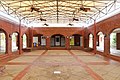 Inside the Casino
 -
 Neptune Park
 -
![Neptune Small plaque[90]](//upload.wikimedia.org/wikipedia/commons/thumb/4/4d/Neptune_Small_plaque%2C_St._Simons%2C_GA%2C_US.jpg/120px-Neptune_Small_plaque%2C_St._Simons%2C_GA%2C_US.jpg) Neptune Small plaque[90]
Neptune Small plaque[90]


![Neptune Small plaque[90]](/File:Neptune_Small_plaque,_St._Simons,_GA,_US.jpg)
Points of interest
A. W. Jones Heritage Center

Opened in 2008, the A.W. Jones Heritage Center at 610 Beachview Drive is the headquarters facility for the Coastal Georgia Historical Society. The 10,000 sq. ft. building contains an entrance gallery featuring exhibits, an executive board room, a gift shop, a 1,400 sq. ft. event hall available for rent, a research library, and the Society's vast collection of objects, artifacts, and archival materials from hundreds of years of coastal Georgia history.
Arthur J. Moore Methodist Museum and Library
Dedicated in June 1966, the Arthur J. Moore Methodist Museum and Library is on the grounds of

Avenue of the Oaks
Initially planted in 1850 by Anne Page King as the carriage entrance to Retreat Plantation, two rows of live oaks grace the Sea Island Golf Club entry at the south end of St. Simons Island on Retreat Avenue, off Kings Way. Visitors can view the oaks by driving toward the entrance to the Golf Club, then circling back.
Bloody Marsh Battle Site
At the Battle of Bloody Marsh on July 7, 1742, an outnumbered force of British soldiers ambushed and defeated Spanish troops, halting a planned attack on Fort Frederica. Markers and information panels at this outdoor observation site explain the battle, which permanently ended Spain's claims to the Georgia territory. Located off Old Demere Road, the site is managed by the National Park Service as a unit of Fort Frederica National Monument.
Cannon's Point Preserve
A 600-acre
Cassina Garden Club Tabby Slave Cabins

Located on Gascoigne Bluff, Hamilton Plantation was one of the most prosperous plantations on St. Simons Island, growing high-quality Sea Island cotton. Of the several slave cabins built on the plantation, two remain today. These slave cabins were constructed of tabby, a concrete-like mixture of lime, sand, water, and oyster shells. Owned and operated by the Cassina Garden Club, the cabins are open to the public on Wednesdays in June, July, and August. Private tours can be arranged at other times.
Christ Church

In 1808 the state of Georgia gave 100 acres (40 hectares) of land on St. Simons to be used for an Episcopal church and its support. Called Christ Church, the structure was finished in 1820. During the Civil War, invading U.S. troops commandeered the small building to stable horses and virtually destroyed it.[91] The church was restored in 1884 by lumber magnate Anson Phelps Dodge, whose son became the new church's first rector. Located at 6329 Frederica Road, just south of Fort Frederica National Monument, this historic building is home to an active Episcopal congregation.[92] The adjacent cemetery contains gravesites dating as far back as 1803.[93]
Epworth By The Sea
Epworth By The Sea is a 100-acre conference and retreat center owned by the South Georgia Conference of the United Methodist Church. The property at Gascoigne Bluff includes six motels, 12 family apartments, 13 youth cabins, auditoriums, classrooms, and meeting rooms. Four dining rooms and a preschool/nursery building with a fenced playground exist. An in-season swimming pool, athletic field, covered basketball courts, tennis courts, bicycle rentals, and fishing piers provide activities for all ages. Lovely Lane Chapel, constructed in 1880, hosts Sunday services and is available for weddings.
Fort Frederica National Monument
Gascoigne Bluff
Gascoigne Bluff has been a focal point for almost the entire history of St. Simons Island. Long before the arrival of Europeans, Native Americans and Aborigines lived and camped on the site. The Spanish also built a mission on or near the area. When General Oglethorpe and the British arrived in 1736, they established a naval facility at the bluff and granted 500 acres (200 hectares) of its land to Captain James Gascoigne, of the sloop-of-war Hawk, and the name persists to this day. In 1794, lumber from the area was used to construct the frigate, "Old Ironsides." During the antebellum period of cotton farming, the bluff was the site of the Hamilton plantation, of which two slave cabins remain standing today. In the late 19th century, lumber mills thrived at the scene. Today, the bluff is occupied by Epworth By The Sea and Gascoigne Bluff Park at its southern end, with picnic tables, restrooms, and a fishing pier.
Lovely Lane Chapel

In 1880, Norman W. Dodge built St. James Union Church at Gascoigne Bluff to serve the lumber mill community. After the mills shut down, the building was deconsecrated in the 1920s and became a social hall. When the Methodists acquired the property in 1949, they renamed it Lovely Lane Chapel. The chapel is open to the public for Sunday worship services and wedding ceremonies. It is located at 100 Arthur J. Moore Drive.
World War II Home Front Museum at the Historic Coast Guard Station

The Coastal Georgia Historical Society operates the World War II Home Front Museum. The Museum is housed in the Historic St. Simons Coast Guard Station, built in 1936. Step back to April 8, 1942, when the crew from this station rescued survivors of two American ships torpedoed by a German U-boat 13 miles off St. Simons Island. Visitors of all ages will be inspired by the stories of ordinary Americans doing their part to win the war.
St. Simons Island Lighthouse Museum
The original St. Simons Island Light, built in 1811, was destroyed by Confederate troops in 1861 to prevent its use by U.S. Navy sailors. Rebuilt in 1872, it continues to operate today, owned by the Coastal Georgia Historical Society and maintained by the United States Coast Guard Auxiliary. The adjacent keeper's residence Is now a museum operated by the Coastal Georgia Historical Society, featuring lighthouse exhibits and a restored keeper's dwelling. Visitors may climb the 129 steps to the observatory for panoramic views of the ocean, nearby islands, and the mainland.
Education


St. Simons Island is part of the Glynn County School District.[94] There are two public schools on the Island: Oglethorpe Point Elementary and St. Simons Elementary, serving grades PK to 5.
Zoned schools include:
- Oglethorpe Point Elementary School (OPES) and St. Simons Elementary School (SSES)[95]
- Glynn Middle School (GMS)[96]
- Glynn Academy (GA)[97]
Private schools:
- Frederica Academy – grades PK-12
- St. Simons Christian School – grades PK-8
Notable people
- Tina McElroy Ansa, novelist, journalist, essayist, and short-story writer.
- U.S. Attorney General
- United States Representativeto congress.
- Morgan Brian, member of the United States women's national soccer team, World Cup Champion, Olympian
- Alton Brown, Food Network Personality
- Jim Brown, Hall of Fame NFL player and actor
- Kwame Brown, Former NBA player, Glynn Academy High School
- Jonathan Byrd, professional golfer
- Jack Davis, cartoonist.
- New York Times Best Seller list
- Brian Harman, professional golfer
- Sam Hunt Part-time resident, country singer.
- Anna Jay, professional wrestler competing at AEW.
- Zach Johnson, professional golfer
- Bessie Jones, gospel singer
- Matt Kuchar, professional golfer
- Davis Love III, professional golfer
- Mack Mattingly, former U.S. Senator
- Atlanta Constitution, San Francisco Chronicle, and former president of National Geographic Society
- U.S. Senator
- Eugenia Price, Author of the Georgia Trilogy and St. Simons Trilogy, among other historical novels.
- Bob Schieffer, American television journalist and former anchor of the CBS Evening News
- MLB pitcher, formerly with the Atlanta Braves
- MLB pitcher for the St. Louis Cardinals
- Larry White, Vice President, Architectural Components Group Inc.
- Heather Whitestone, Miss America 1995, first disabled Miss America.
References
- ^ "2020 U.S. Gazetteer Files". United States Census Bureau. Retrieved December 18, 2021.
- ^ "U.S. Census website". United States Census Bureau. Retrieved December 21, 2015.
- ^ "US Board on Geographic Names". United States Geological Survey. October 25, 2007. Retrieved January 31, 2008.
- ^ Grisamore, Ed (October 17, 2014). "Gris: LBC all about giving back". Macon Telegraph. Retrieved February 9, 2019.
They were oval-shaped with the three simple letters, similar to the popular decals touting vacation destinations -- SSI for St. Simons Island, TYB for Tybee Island and PCB for Panama City Beach.
- ^ Wolfe, Wes (February 7, 2019). "Local delegates join fight against offshore energy exploration". The Brunswick News. Archived from the original on February 7, 2019. Retrieved February 9, 2019.
State Rep. Don Hogan, R-St. Simons Island, said he's lived on SSI for 52 years...
- ^ Chamberlain, Chris (November 10, 2017). "48 Hours in St. Simons Island". StyleBlueprint. Archived from the original on March 31, 2018. Retrieved February 9, 2019.
No trip to SSI (as the locals refer to the island)...
- ^ Starr, Mary (March 29, 2017). "Garden walk is all about community". Coastal Illustrated. Archived from the original on October 25, 2017. Retrieved February 9, 2019.
...there will be members of the SSI Family Gardening Club...
- ^ a b "2020 Race and Population Totals". data.census.gov. Retrieved December 18, 2021.
- ^ "Profile of General Population and Housing Characteristics: 2010". American Factfinder. U.S. Census Bureau. Archived from the original on February 13, 2020. Retrieved December 18, 2015.
- ^ "St. Simons Land Trust". St. Simons Land Trust. Archived from the original on December 22, 2015. Retrieved December 18, 2015.
- ^ "Fort Frederica National Monument - History & Culture". National Park Service. Retrieved December 18, 2015.
- ^ Sullivan, Buddy (2003). Georgia: A State History. Charleston, South Carolina: Arcadia Publishing. p. 71.
- ^ Russo, Michael (2006). "Archaic Shell Rings of the Southeast U. S." (PDF). National Park Service. pp. 85–86. Archived from the original (PDF) on April 15, 2012. Retrieved April 25, 2019.
- ^ Milanich, Jerald T. (September 1997). "A Chronology for the Aboriginal Cultures of Northern St. Simon's Island, Georgia". The Florida Anthropologist. 30 (3): 134–42 – via University of Florida Digital Collections.
- ^ Hann 1996, pp. 70, 176.
- ^ Ashley, Rolland & Thunen 2013, pp. 397–400.
- ^ Ashley, Rolland & Thunen 2013, pp. 397, 421.
- ^ Hann 1996, p. 175.
- ^ Milanich 1995, pp. 115, 172.
- ^ Ashley, Rolland & Thunen 2013, p. 401.
- ^ Hann 1996, pp. 269, 271–72.
- ^ Worth 2007, pp. 19–20, 98.
- ^ Hann 1996, pp. 268–69.
- ^ Hann 1996, pp. 270–71.
- ^ Milanich 2006, p. 174.
- ^ Hann 1996, p. 271.
- ^ Fort Frederica National Monument, 6515 Frederica Road, St. Simons Island, GA 31522, Historic_Places, http://www.nps.gov/fofr/, National Park Service
- ^ http://www.nps.gov/fofr/historyculture/.../cate.pdf [dead link]
- ^ "Wesley Oak (historic marker), Historical Markers". www.glynncounty.com.
- ^ "St. Simons Island". New Georgia Encyclopedia. Retrieved July 13, 2022.
- ^ Vanstory, Burnette (1981). Georgia's Land of the Golden Isles. Athens, GA: University of Georgia Press. p. 139.
- ^ "Harrington Community, Communities". www.glynncounty.com. Retrieved January 13, 2016.
- ^ Wilkerson, Lyn (2000). Roads Less Traveled: Exploring America's Past on Its Back Roads. Writers Club Press. p. 311.
- ^ a b c Green, R. Edwin (2004). St. Simons Island: A Summary of Its History. Charleston, South Carolina: The History Press. p. 61.
- ^ GLYNN COUNTY HISTORIC RESOURCES SURVEY REPORT. Savannah, GA: Quatrefoil Historic Preservation Consulting. 2009. p. 25.
- ^ Morris, Patricia (2003). Images of America: St. Simons Island. Charleston, South Carolina: Arcadia Publishing. p. 104.
- ^ "History of Saint Simons Island, Georgia". www.glynncounty.com. Retrieved January 13, 2016.
- ^ "World War II: German U-Boat Attacks". todayingeorgiahistory.org/. Retrieved January 13, 2016.
- ^ "Coastal Georgia Historical Society". www.saintsimonslighthouse.org. Archived from the original on August 26, 2014. Retrieved January 13, 2016.
- ^ "Georgia Historic Hotel, Historic Beach Resort | The King and Prince". www.kingandprince.com. Retrieved January 13, 2016.
- ^ Killough, Ashley (October 8, 2014). "Carter criticizes Obama on ISIS: 'We waited too long". CNN. See photo 10.
- ^ "History of Saint Simons Island, Georgia, GA". www.glynncounty.com. Retrieved January 13, 2016.
- ^ Bureau, U.S. Census. "U.S. Census website". United States Census Bureau. Retrieved January 13, 2016.
- ^ "US Gazetteer files: 2010, 2000, and 1990". United States Census Bureau. February 12, 2011. Retrieved April 23, 2011.
- ^ "7(v) Climate Classification and Climatic Regions of the World". www.physicalgeography.net. Retrieved December 21, 2015.
- ^ "University Of Georgia". georgiaseagrant.uga.edu. Retrieved December 21, 2015.
- ^ Service, US Department of Commerce, NOAA, National Weather. "Christmas Coastal Snowstorm: December 22-24, 1989". www.weather.gov. Retrieved December 21, 2015.
{{cite web}}: CS1 maint: multiple names: authors list (link) - ^ "USDA Plant Hardiness Zone Map". planthardiness.ars.usda.gov. Archived from the original on February 27, 2014. Retrieved December 21, 2015.
- ^ "Sherpa Guides | Georgia | Coast | Southern Coast | St. Simons Island". www.sherpaguides.com. Retrieved January 2, 2016.
- ^ "Gould's Inlet, St. Simons Island". www.sherpaguides.com. Retrieved January 2, 2016.
- ^ "Georgia's Colonial Coast Birding Trail | Georgia DNR - Wildlife Resources Division". georgiawildlife.com. Retrieved January 2, 2016.
- ^ "Visit Cannon's Point Preserve". St. Simons Land Trust. St. Simons Land Trust, Inc. Archived from the original on December 22, 2015. Retrieved January 2, 2016.
- US Census Bureau.
- US Census Bureau. 1870.
- US Census Bureau. 1880.
- US Census Bureau. 1930.
- US Census Bureau. 1930. pp. 251–256.
- US Census Bureau. 1940.
- ^ US Census Bureau. 1980.
- US Census Bureau. 1960.
- US Census Bureau. 1970.
- ^ US Census Bureau. 1980.
- US Census Bureau. 1990.
- US Census Bureau. 2000.
- ^ a b "P2: Hispanic or Latino, and Not Hispanic or Latino by Race – 2010: DEC Redistricting Data (PL 94-171) – St. Simons CDP, Georgia". United States Census Bureau.
- ^ a b "P2: Hispanic or Latino, and Not Hispanic or Latino by Race – 2020: DEC Redistricting Data (PL 94-171) – St. Simons CDP, Georgia". United States Census Bureau.
- ^ "P004 Hispanic or Latino, and Not Hispanic or Latino by Race – 2000: DEC Summary File 1 – St. Simons CDP, Georgia". United States Census Bureau.
- ^ Bureau, U.S. Census. "American FactFinder - Results". factfinder.census.gov. Retrieved December 21, 2015.[permanent dead link]
- ^ "2020 ACS Income Statistics". data.census.gov. Retrieved July 13, 2022.
- ^ Bureau, U.S. Census. "American FactFinder - Results". factfinder.census.gov. Archived from the original on February 13, 2020. Retrieved January 21, 2016.
- ^ "2020 ACS Financial Estimates Households W/Mortgages". data.census.gov. Retrieved July 13, 2022.
- U.S. Postal Service. Retrieved March 1, 2023.
- ^ Bureau, U.S. Census. "American FactFinder - Results". factfinder.census.gov. Archived from the original on February 14, 2020. Retrieved January 21, 2016.
- ^ "Glynn County's Top Employers". Brunswick and Glynn County Development Authority. Retrieved January 21, 2016.
- ^ "Home". Glynn Visual Arts. Archived from the original on March 4, 2016. Retrieved January 14, 2016.
- ^ "Literary Guild of St. Simons Island". Literary Guild of St. Simons Island. Retrieved January 14, 2016.
- ^ "theislandplayers". theislandplayers. Retrieved January 14, 2016.
- ^ "Home". islandconcertassociation.org. Retrieved January 14, 2016.
- ISSN 0362-4331. Retrieved January 14, 2016.
- ISBN 9780809243266.
- ^ "Our History". www.fabsaintsimons.org. Archived from the original on February 7, 2016. Retrieved January 14, 2016.
- ^ Brown, Brian (March 9, 2020). "First African Baptist Church, 1869, St. Simons Island". Vanishing Georgia: Photographs by Brian Brown. Retrieved July 13, 2022.
- ^ "SSAAHC | St. Simons African-American Heritage Coalition - History of SSAAHC". www.ssiheritagecoalition.org. Archived from the original on February 7, 2016. Retrieved January 14, 2016.
- ^ "Saint Simons Island, Georgia Golf Courses". www.golflink.com. Archived from the original on May 31, 2016. Retrieved January 14, 2016.
- ^ "Glynn County, GA - Official Website - Parks". www.glynncounty.org. Retrieved January 14, 2016.
- ^ "Neptune Park Fun Zone". www.goldenisles.com.
- ^ "Glynn County, GA - Official Website - Beaches and Pools". glynncounty.org. Retrieved January 14, 2016.
- ^ "Island-Wide Trail System | PATH Foundation". pathfoundation.org. Archived from the original on March 24, 2016. Retrieved January 14, 2016.
- ^ "Neptune Small (1831-1907)". New Georgia Encyclopedia.
- ^ Inscription: NEPTUNE SMALL For generations, residents and visitors have enjoyed Neptune Park, named for Neptune Small, a faithful servant of the Thomas Butler King family at Retreat Plantation, now the home of the Sea Island Golf Club. Born into slavery in 1831, Neptune accompanied one of the King sons, Henry Lord Page King, as manservant when he enlisted in the Confederate Army. During the battle of Fredericksburg in 1862, Captain King was killed. When night fell, Neptune retrieved King's body and brought it home for burial in the family burial ground at Christ Church, Frederica, St. Simons. Although he could have chosen to remain at home, Neptune returned to the war as a manservant to the youngest King son, R. Guyler King. After the war the King family gave this portion of Retreat Plantation to Neptune who, as a freedman, had chosen "Small" as his last name for his slight stature. Neptune died in 1907 and is buried in the Retreat burial ground. This marker and live oak tree are given and dedicated by Sea Island Company to his memory.
- ^ "Gateway to the Golden Isles".
- ^ "Christ Church, Brunswick, Georgia, Saint Simons Island, Jekyll Island, GA". www.glynncounty.com. Retrieved January 13, 2016.
- ^ "Christ Church and Cemetery - St. Simons Island, Georgia". www.exploresouthernhistory.com. Retrieved January 13, 2016.
- .
- ^ "Elementary School Zones Map Archived March 12, 2019, at the Wayback Machine." Glynn County School System. Retrieved on March 13, 2019.
- ^ "Middle School Zones Map Archived March 12, 2019, at the Wayback Machine." Glynn County School System. Retrieved on March 13, 2019. Detail of Glynn MS Zone Map Archived March 12, 2019, at the Wayback Machine
- ^ "High School Zones Map Archived March 12, 2019, at the Wayback Machine." Glynn County School System. Retrieved on March 13, 2019.
Sources
- Ashley, Keith H.; Rolland, Vicky L.; Thunen, Robert L. (2013). "Chapter Fifteen: Mission San Buenaventura and Santa Cruz de Gualdalquini: Retreat from the Georgia Coast". In Thomas, David Hurst; Thompson, Victor D.; Alexander, Clark R.; Ashley, Keith H.; Blair, Elliot; Cordell, Ann S.; Deagan, Kathleen A.; DePratter, Chester B.; ISSN 0065-9452.
- Hann, John H. (1996). A History of the Timucua Indians and Missions. Gainesville, Florida: University Press of Florida. pp. 70, 175–177, 270–271. ISBN 978-0-8130-1424-1.
- Milanich, Jerald T. (1995). Florida Indians and the Invasion of Europe. Gainesville, Florida: University Press of Florida. ISBN 978-0-8130-1636-8.
- Milanich, Jerald T. (2006). Laboring in the Fields of the Lord (Paperback ed.). Gainesville, Florida: University Press of Florida. ISBN 978-0-8130-2966-5.
- Worth, John E. (2007). The Struggle for the Georgia Coast. University of Alabama Press. ISBN 9780817354114.
External links
- Golden Isles Visitors Bureau, Golden Isles Visitors Bureau
- Glynn County Government
- History of St. Simons Island Archived September 26, 2007, at the Wayback Machine, New Georgia Encyclopedia
- St. Simons Island, Sherpa Guides
- Coastal Georgia Historical Society
- St. Simon's Light Station Archived September 9, 2005, at the Wayback Machine, National Park Service
- More about the St. Simons Lighthouse
- List of historical hurricanes, 1565 to 1899, National Oceanic and Atmospheric Administration
- Frederica Naval Action Archived December 15, 2018, at the Wayback Machine
- St. Simons Island historical marker
- St. Simons Trolley Stop historical marker
Municipalities and communities of Glynn County, Georgia, United States | ||
|---|---|---|
| City | 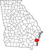 | |
| CDPs |
| |
| Other unincorporated communities | ||
| Ghost towns | ||
| ||
| Authority control databases: Geographic |
|---|