Vanua Levu
This article needs additional citations for verification. (January 2008) |
Fiji Indians |
Vanua Levu (pronounced .
Geology
Fiji lies in a
Geography


The main part of the island is roughly shaped like a tall, thin triangle 30 to 50 kilometres (19–31 miles) in width and 180 kilometres (110 miles) in length, rotated so that the point is to the northeast. This point, the northernmost in the Fiji chain, is
A rugged mountain range divides the island horizontally, forming much of the boundary between the
stands. None of the island's rivers are navigable by large vessels. There are also many well known rivers on Vanua levu. The first is the most dangerous, the Wainikoro river, known for its shark attacks. The second is the Dreketi river, the deepest river in Fiji.Flora and fauna
A 17,600 hectares (43,000 acres) area covering much of the interior of the Natewa/Tunuloa peninsula is the Natewa/Tunuloa Peninsula
Demographics and economic activities

The island's main population centres are the towns of Labasa, in the north, and
Politics
For administrative purposes, Vanua Levu is divided into three provinces:
History

Vanua Levu was settled about 3,100 years ago, with the settlers living in houses raised above the reefs on the shores. Between 1250 and 1350, the Pacific sea level fell 30 centimetres (12 in), exposing the tops of the reefs. This killed the abundant sea food, it also dropped the ground water table below the depth of the roots of the crops. The scarcity of food caused conflict and war. In response, the people moved from seaside villages, for mountaintop fortified villages. These forts were occupied until about 1870, with the last clear indication of warfare about 1860.[6]
The
Traders began exploiting
Settlers from Australia and New Zealand established
In March 2012, the country of
On December 19, 2020, Cyclone Yasa slammed into the island, killing at least four people and causing millions of dollars in damage. 24,000 people were evacuated from their homes.[9]
Transport
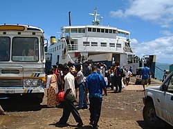
Ferry service by
References
- ^ Greenbaum, D.; Bowker, M. R; Dau, I; Drospy, H; Greally, K. B; McDonald A. J. W; Marsh, S. H; Northmore, K. J; O'Connor, E. A; Prasad, R. S & Tragheim, D. G. (1995). "Landslide hazards in Fiji" (PDF). Technical Report WC/95/28 Rapid methods of landslide hazard mapping : Fiji case study. British Geological Survey. Retrieved 23 March 2011.
- ^ Provisional Geologic Map of Fiji. Suva: Fiji Geological Survey. 1965.
- .
- ^ "BirdLife Data Zone: Natewa/Tunuloa Peninsula". datazone.birdlife.org. Retrieved 30 May 2017.
- ^ "Wesleyan Chapel, Naivuki, Vanua-Levu, Feejee". The Wesleyan Juvenile Offering: A Miscellany of Missionary Information for Young Persons. X. Wesleyan Missionary Society: 67–97. September 1853. Retrieved 29 February 2016.
- ^ Patrick Nunn (June 21, 2016). "Fiji's experience with sea-level rise 600 years ago shows how climate change can inspire violence". Slate.com. Retrieved August 11, 2016.
- ISBN 978-0-8166-0853-9.
argo schooner fiji.
- ^ Paul Chapman (2012-03-07). "Entire nation of Kiribati to be relocated over rising sea level threat". The Daily Telegraph. Retrieved 2012-03-08.
- ^ "Fiji: Devastation caused by Cyclone Yasa compared to war zone". Al Jazeera. Retrieved December 19, 2020.
External links
![]() Vanua Levu travel guide from Wikivoyage
16°35′S 179°11′E / 16.583°S 179.183°E
Vanua Levu travel guide from Wikivoyage
16°35′S 179°11′E / 16.583°S 179.183°E
