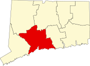
Wallingford Center, Connecticut
Appearance
Wallingford Center, Connecticut | |
|---|---|
UTC-4 (EDT) | |
| ZIP Code | 06492 (Wallingford) |
| Area code(s) | 203/475 |
| FIPS code | 09-78880 |
| GNIS feature ID | 2377875[2] |
Wallingford Center is a
Wilbur Cross Parkway, to the east by Interstate 91, and to the south by the town of North Haven. To the north the CDP extends (from east to west) to New Rock Hill Road, Durham Road, Christian Street, North Elm Street, Maplewood Avenue, and up North Main Street as far as Yale Avenue, where it crosses the Wilbur Cross Parkway. U.S. Route 5 (Colony Street) is the main north–south road through the community. To the north is the neighborhood of Yalesville
.
As of the 2010 census, the Wallingford Center CDP had a population of 18,209,[3] out of 45,135 in the entire town of Wallingford.
References
- ^ "2020 U.S. Gazetteer Files – Connecticut". United States Census Bureau. Retrieved April 14, 2021.
- ^ a b "Wallingford Center Census Designated Place". Geographic Names Information System. United States Geological Survey, United States Department of the Interior.
- ^ a b "Total Population: 2010 Census DEC Summary File 1 (P1), Wallingford Center CDP, Connecticut". data.census.gov. U.S. Census Bureau. Retrieved April 14, 2021.

